


càbottes

clabidault
User
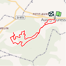

Length
8.5 km

Max alt
438 m

Uphill gradient
197 m
Km-Effort
11.1 km

Min alt
256 m

Downhill gradient
199 m
Boucle
Yes
Creation date :
2018-04-17 22:37:23.184
Updated on :
2019-05-13 19:26:25.275
2h24
Difficulty : Unknown

FREE GPS app for hiking
 SityTrail
IGN / Geographical institutes
SityTrail Plus
The world is yours!
About
Trail Walking of 8.5 km to be discovered at Bourgogne-Franche-Comté, Côte-d'Or, Auxey-Duresses. This trail is proposed by clabidault.
Positioning
Country:
France
Region :
Bourgogne-Franche-Comté
Department/Province :
Côte-d'Or
Municipality :
Auxey-Duresses
Location:
Unknown
Start:(Dec)
Start:(UTM)
632809 ; 5205109 (31T) N.
Comments