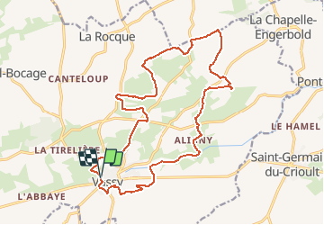
Trail Walking Valdallière - VASSY - Photo
 UDGI54
UDGI54

User

© OpenStreetMap contributors
Length
Length
19.1 km
Max alt
Max alt
214 m
Uphill gradient
Uphill gradient
303 m
Km-Effort
Km-Effort  
23 km
Min alt
Min alt
123 m
Downhill gradient
Downhill gradient
301 m
Boucle
Boucle
Yes
Creation date :
2018-04-17 23:05:11.751
Updated on :
2018-04-17 23:05:11.751

(0 Reviews)

Walking
Walking
5h00
Difficulty : Unknown

Scan this QR Code to open this trail in the SityTrail application

FREE GPS app for hiking

Logo SityTrail SityTrail

IGN / Geographical institutes

Download SityTrail from the App Store Download SityTrail from Google Play

Logo SityTrail SityTrail Plus

The world is yours!

Download SityTrail from the App Store Download SityTrail from Google Play Download SityTrail on Huawei AppGallery

About

Trail Walking of 19.1 km to be discovered at Normandy, Calvados, Valdallière. This trail is proposed by UDGI54.

Elevation profile

Points of interest

Point of interest Valdallière - 1 - Photo
UDGI54
VALDALLIÈRE 
Point of interest Valdallière - 2 - Photo
UDGI54
VALDALLIÈRE 
Point of interest Valdallière - 3 - Photo
UDGI54
VALDALLIÈRE 
Point of interest Valdallière - 4 - Photo
UDGI54
VALDALLIÈRE 
Point of interest Valdallière - 5 - Photo
UDGI54
VALDALLIÈRE 
Point of interest Valdallière - 6 - Photo
UDGI54
VALDALLIÈRE 
Point of interest Valdallière - 7 - Photo
UDGI54
VALDALLIÈRE 

Positioning

Country:
France
Region :
Normandy
Department/Province :
Calvados
Municipality :
Valdallière
Location:
Unknown
Start:(UTM)
670354 ; 5413818 (30U) N.


Close
My subscriptions