


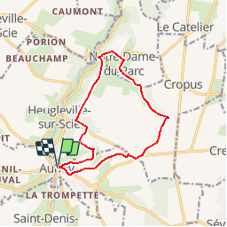
Auffay la corbière Au Pont Rouge (124)

randovivi
User

Length
11.9 km

Max alt
156 m

Uphill gradient
189 m
Km-Effort
14.4 km

Min alt
80 m

Downhill gradient
190 m
Boucle
Yes
Creation date :
2018-04-17 23:08:21.902
Updated on :
2018-04-17 23:08:21.902
3h07
Difficulty : Easy

FREE GPS app for hiking
 SityTrail
IGN / Geographical institutes
SityTrail Plus
The world is yours!
About
Trail Walking of 11.9 km to be discovered at Normandy, Seine-Maritime, Val-de-Scie. This trail is proposed by randovivi.
Description
Auffay La Corbière au Pont Rouge
Départ Place Centrale D'Auffay
Positioning
Country:
France
Region :
Normandy
Department/Province :
Seine-Maritime
Municipality :
Val-de-Scie
Location:
Auffay
Start:(Dec)
Start:(UTM)
363041 ; 5509143 (31U) N.
Comments