


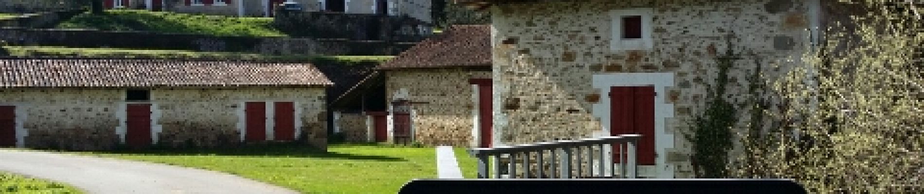
Roussines et la vallée de Montizon

alainjoseph6
User

Length
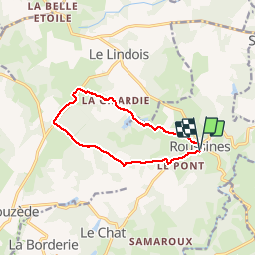
10.7 km

Max alt
296 m

Uphill gradient
181 m
Km-Effort
13.1 km

Min alt
203 m

Downhill gradient
180 m
Boucle
Yes
Creation date :
2018-04-17 23:44:11.554
Updated on :
2019-02-03 18:43:08.363
2h50
Difficulty : Easy

FREE GPS app for hiking
 SityTrail
IGN / Geographical institutes
SityTrail Plus
The world is yours!
About
Trail Walking of 10.7 km to be discovered at New Aquitaine, Charente, Roussines. This trail is proposed by alainjoseph6.
Description
Une randonnée trés vallonnée oû l'ont peut découvrir 14 étangs dont celui de la grole et de Montizon.
Photos


Positioning
Country:
France
Region :
New Aquitaine
Department/Province :
Charente
Municipality :
Roussines
Location:
Unknown
Start:(Dec)
Start:(UTM)
314761 ; 5065997 (31T) N.
Comments