


vers Gouvieux

sambres
User
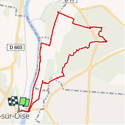

Length
9.5 km

Max alt
49 m

Uphill gradient
57 m
Km-Effort
10.3 km

Min alt
22 m

Downhill gradient
55 m
Boucle
Yes
Creation date :
2018-04-17 23:49:01.212
Updated on :
2018-04-17 23:49:01.212
2h33
Difficulty : Medium

FREE GPS app for hiking
 SityTrail
IGN / Geographical institutes
SityTrail Plus
The world is yours!
About
Trail Other activity of 9.5 km to be discovered at Hauts-de-France, Oise, Boran-sur-Oise. This trail is proposed by sambres.
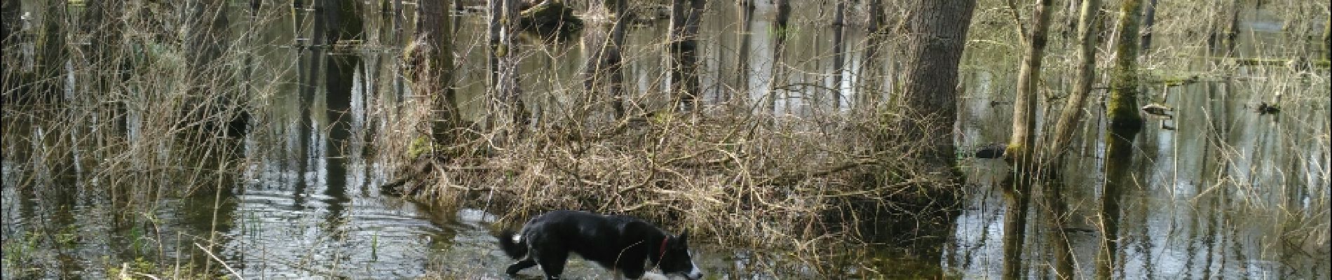
Photos


Positioning
Country:
France
Region :
Hauts-de-France
Department/Province :
Oise
Municipality :
Boran-sur-Oise
Location:
Unknown
Start:(Dec)
Start:(UTM)
453611 ; 5446335 (31U) N.
Comments