


Aven Orgnac

dadodeca
User
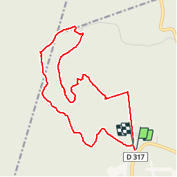

Length
4.9 km

Max alt
369 m

Uphill gradient
128 m
Km-Effort
6.6 km

Min alt
286 m

Downhill gradient
127 m
Boucle
Yes
Creation date :
2018-04-18 00:26:31.586
Updated on :
2018-04-18 00:26:31.586
1h56
Difficulty : Easy

FREE GPS app for hiking
 SityTrail
IGN / Geographical institutes
SityTrail Plus
The world is yours!
About
Trail Walking of 4.9 km to be discovered at Auvergne-Rhône-Alpes, Ardèche, Orgnac-l'Aven. This trail is proposed by dadodeca.
Description
Aven , Dolmen circuit à faire l'été protéger des arbres.
Positioning
Country:
France
Region :
Auvergne-Rhône-Alpes
Department/Province :
Ardèche
Municipality :
Orgnac-l'Aven
Location:
Unknown
Start:(Dec)
Start:(UTM)
612544 ; 4908150 (31T) N.
Comments
début du circuit GPS pas fidèle à la trace réel. circuit pour jours de fortes chaleurs ou jours de pluie.