Trail Walking Lourdes - Lourdes Pic du Jer en boucle G3 fait - Photo

Lourdes Pic du Jer en boucle G3 fait

convivialite, sport et fiesta

© OpenStreetMap contributors
Length
Length
9.8 km
Max alt
Max alt
942 m
Uphill gradient
Uphill gradient
504 m
Km-Effort
Km-Effort  
16.6 km
Min alt
Min alt
420 m
Downhill gradient
Downhill gradient
542 m
Boucle
Boucle
Yes
Creation date :
2019-04-29 08:26:30.377
Updated on :
2019-04-29 08:26:30.416

(0 Reviews)

Walking
Walking
3h30
Difficulty : Easy

Scan this QR Code to open this trail in the SityTrail application

FREE GPS app for hiking

Logo SityTrail SityTrail

IGN / Geographical institutes

Download SityTrail from the App Store Download SityTrail from Google Play

Logo SityTrail SityTrail Plus

The world is yours!

Download SityTrail from the App Store Download SityTrail from Google Play Download SityTrail on Huawei AppGallery

About

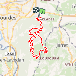
Trail Walking of 9.8 km to be discovered at Occitania, Hautespyrenees, Lourdes. This trail is proposed by Lous Passa camins.

Description

Beaucoup de gens sont monts au pic du Jer mais peu sont descendus par le cote sud. Ca y est c'est chose faite a la grande joie de tout le G3 de LPC

Elevation profile

Positioning

Country:
France
Region :
Occitania
Department/Province :
Hautespyrenees
Municipality :
Lourdes
Location:
Unknown
Start:(UTM)
741858 ; 4775524 (30T) N.


Close
My subscriptions