


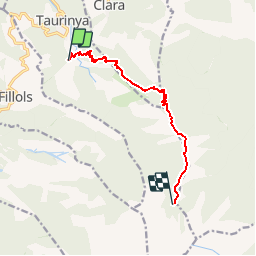
TAURYNIA CORTALETS

UDGI54
User

Length
9.1 km

Max alt
2158 m

Uphill gradient
1532 m
Km-Effort
25 km

Min alt
623 m

Downhill gradient
25 m
Boucle
No
Creation date :
2018-06-26 10:45:29.16
Updated on :
2018-06-26 10:45:29.16
5h34
Difficulty : Difficult

FREE GPS app for hiking
 SityTrail
IGN / Geographical institutes
SityTrail Plus
The world is yours!
About
Trail Walking of 9.1 km to be discovered at Occitania, Pyrénées-Orientales, Taurinya. This trail is proposed by UDGI54.
Positioning
Country:
France
Region :
Occitania
Department/Province :
Pyrénées-Orientales
Municipality :
Taurinya
Location:
Unknown
Start:(Dec)
Start:(UTM)
453146 ; 4713293 (31T) N.
Comments