


Terrain d'aeromodelisme - le rocher du diable

Gegetop
User

Length
9.9 km

Max alt
492 m

Uphill gradient
174 m
Km-Effort
12.3 km

Min alt
370 m

Downhill gradient
174 m
Boucle
Yes
Creation date :
2018-06-26 12:31:28.637
Updated on :
2018-06-26 12:31:28.637
1h55
Difficulty : Easy

FREE GPS app for hiking
 SityTrail
IGN / Geographical institutes
SityTrail Plus
The world is yours!
About
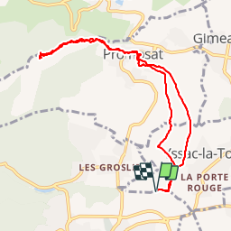
Trail Walking of 9.9 km to be discovered at Auvergne-Rhône-Alpes, Puy-de-Dôme, Châtel-Guyon. This trail is proposed by Gegetop.
Description
aller, retour
Positioning
Country:
France
Region :
Auvergne-Rhône-Alpes
Department/Province :
Puy-de-Dôme
Municipality :
Châtel-Guyon
Location:
Unknown
Start:(Dec)
Start:(UTM)
506367 ; 5086329 (31T) N.
Comments