


Le Pont des Sarrasins

raab
User
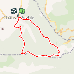

Length
7.4 km

Max alt
786 m

Uphill gradient
478 m
Km-Effort
13.8 km

Min alt
375 m

Downhill gradient
477 m
Boucle
Yes
Creation date :
2018-07-30 16:23:24.161
Updated on :
2018-07-30 16:23:24.243
3h10
Difficulty : Medium

FREE GPS app for hiking
 SityTrail
IGN / Geographical institutes
SityTrail Plus
The world is yours!
About
Trail Walking of 7.4 km to be discovered at Auvergne-Rhône-Alpes, Drôme, Châteaudouble. This trail is proposed by raab.
Positioning
Country:
France
Region :
Auvergne-Rhône-Alpes
Department/Province :
Drôme
Municipality :
Châteaudouble
Location:
Unknown
Start:(Dec)
Start:(UTM)
665463 ; 4973913 (31T) N.
Comments