


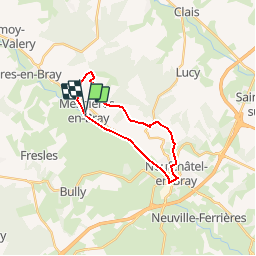
boucle Mesnières ,Mesnerettes, Neufchâtel

kikidenis1
User

Length
17.5 km

Max alt
224 m

Uphill gradient
290 m
Km-Effort
21 km

Min alt
60 m

Downhill gradient
287 m
Boucle
Yes
Creation date :
2018-06-27 11:41:12.453
Updated on :
2018-06-27 11:41:12.453
4h42
Difficulty : Easy

FREE GPS app for hiking
 SityTrail
IGN / Geographical institutes
SityTrail Plus
The world is yours!
About
Trail Walking of 17.5 km to be discovered at Normandy, Seine-Maritime, Mesnières-en-Bray. This trail is proposed by kikidenis1.
Positioning
Country:
France
Region :
Normandy
Department/Province :
Seine-Maritime
Municipality :
Mesnières-en-Bray
Location:
Unknown
Start:(Dec)
Start:(UTM)
383288 ; 5513303 (31U) N.
Comments