


06.05.2018-Schlucht- Hirschsteine-Lac Vert-Tanet

delm
User
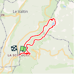

Length
13.3 km

Max alt
1281 m

Uphill gradient
586 m
Km-Effort
21 km

Min alt
1049 m

Downhill gradient
591 m
Boucle
Yes
Creation date :
2018-06-26 13:20:09.254
Updated on :
2018-06-26 13:20:09.254
3h44
Difficulty : Difficult

FREE GPS app for hiking
 SityTrail
IGN / Geographical institutes
SityTrail Plus
The world is yours!
About
Trail Walking of 13.3 km to be discovered at Grand Est, Vosges, Le Valtin. This trail is proposed by delm.
Description
Très belle randonnée. Très difficile le passage de Hirschsteine.
Positioning
Country:
France
Region :
Grand Est
Department/Province :
Vosges
Municipality :
Le Valtin
Location:
Unknown
Start:(Dec)
Start:(UTM)
352729 ; 5325303 (32U) N.
Comments