


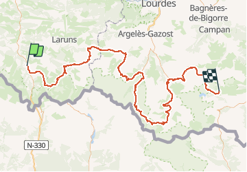
Trace GPS de Borce (Pyrénées-Atlantiques) au Lac de l'Oule (Hautes-Pyrénées)

tigrou31
User

Length
175 km

Max alt
2738 m

Uphill gradient
11595 m
Km-Effort
326 km

Min alt
595 m

Downhill gradient
10402 m
Boucle
No
Creation date :
2018-06-26 13:22:35.5
Updated on :
2018-06-26 13:22:35.5
61h28
Difficulty : Unknown

FREE GPS app for hiking
 SityTrail
IGN / Geographical institutes
SityTrail Plus
The world is yours!
About
Trail Walking of 175 km to be discovered at New Aquitaine, Pyrénées-Atlantiques, Borce. This trail is proposed by tigrou31.
Description
Trace GPSde Borce (Pyrénées-Atlantiques) au Lac de l'Oule (Hautes-Pyrénées)
Positioning
Country:
France
Region :
New Aquitaine
Department/Province :
Pyrénées-Atlantiques
Municipality :
Borce
Location:
Unknown
Start:(Dec)
Start:(UTM)
698053 ; 4753677 (30T) N.
Comments