


les sources de valdrome

raygautier
User
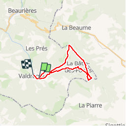

Length
21 km

Max alt
1554 m

Uphill gradient
908 m
Km-Effort
33 km

Min alt
787 m

Downhill gradient
924 m
Boucle
No
Creation date :
2018-06-26 13:40:15.728
Updated on :
2018-06-26 13:40:15.728
5h36
Difficulty : Medium

FREE GPS app for hiking
 SityTrail
IGN / Geographical institutes
SityTrail Plus
The world is yours!
About
Trail Walking of 21 km to be discovered at Auvergne-Rhône-Alpes, Drôme, Valdrôme. This trail is proposed by raygautier.
Positioning
Country:
France
Region :
Auvergne-Rhône-Alpes
Department/Province :
Drôme
Municipality :
Valdrôme
Location:
Unknown
Start:(Dec)
Start:(UTM)
705419 ; 4930925 (31T) N.
Comments