


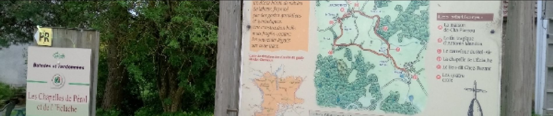
les Chapelles de Pérol et de l'Eclache

Gegetop
User

Length
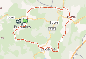
11.3 km

Max alt
956 m

Uphill gradient
256 m
Km-Effort
14.8 km

Min alt
860 m

Downhill gradient
253 m
Boucle
Yes
Creation date :
2018-06-26 13:41:42.379
Updated on :
2018-06-26 13:41:42.379
2h36
Difficulty : Easy

FREE GPS app for hiking
 SityTrail
IGN / Geographical institutes
SityTrail Plus
The world is yours!
About
Trail Walking of 11.3 km to be discovered at Auvergne-Rhône-Alpes, Puy-de-Dôme, Prondines. This trail is proposed by Gegetop.
Description
Cette balade alterne la forêt et les prairies.
Photos


Positioning
Country:
France
Region :
Auvergne-Rhône-Alpes
Department/Province :
Puy-de-Dôme
Municipality :
Prondines
Location:
Unknown
Start:(Dec)
Start:(UTM)
474888 ; 5067519 (31T) N.
Comments