


lasolas la vache vichatel

jeanic63
User
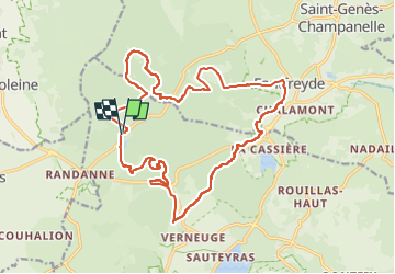

Length
21 km

Max alt
1174 m

Uphill gradient
636 m
Km-Effort
29 km

Min alt
842 m

Downhill gradient
634 m
Boucle
Yes
Creation date :
2018-06-26 14:13:32.789
Updated on :
2023-05-22 17:17:57.456
6h19
Difficulty : Unknown

FREE GPS app for hiking
 SityTrail
IGN / Geographical institutes
SityTrail Plus
The world is yours!
About
Trail Other activity of 21 km to be discovered at Auvergne-Rhône-Alpes, Puy-de-Dôme, Aydat. This trail is proposed by jeanic63.
Description
départ château de montlosier
Positioning
Country:
France
Region :
Auvergne-Rhône-Alpes
Department/Province :
Puy-de-Dôme
Municipality :
Aydat
Location:
Unknown
Start:(Dec)
Start:(UTM)
496231 ; 5060013 (31T) N.
Comments