


VTT n° 2

dudu85
User

Length
42 km

Max alt
252 m

Uphill gradient
516 m
Km-Effort
49 km

Min alt
157 m

Downhill gradient
518 m
Boucle
Yes
Creation date :
2018-06-26 15:38:42.274
Updated on :
2018-06-26 15:38:42.274
3h12
Difficulty : Unknown

FREE GPS app for hiking
 SityTrail
IGN / Geographical institutes
SityTrail Plus
The world is yours!
About
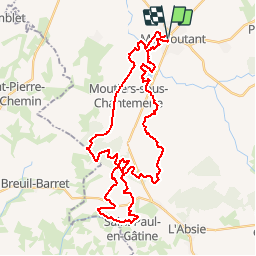
Trail Mountain bike of 42 km to be discovered at New Aquitaine, Deux-Sèvres, Moncoutant-sur-Sèvre. This trail is proposed by dudu85.
Positioning
Country:
France
Region :
New Aquitaine
Department/Province :
Deux-Sèvres
Municipality :
Moncoutant-sur-Sèvre
Location:
Unknown
Start:(Dec)
Start:(UTM)
684106 ; 5177227 (30T) N.
Comments