


RANDO QUAD MATIN DU 10 JUIN

association
User

Length
90 km

Max alt
224 m

Uphill gradient
1040 m
Km-Effort
104 km

Min alt
0 m

Downhill gradient
1250 m
Boucle
No
Creation date :
2018-06-26 15:49:02.618
Updated on :
2018-06-26 15:49:02.618
1h39
Difficulty : Medium

FREE GPS app for hiking
 SityTrail
IGN / Geographical institutes
SityTrail Plus
The world is yours!
About
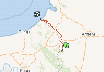
Trail Other activity of 90 km to be discovered at Hauts-de-France, Oise, Blargies. This trail is proposed by association.
Positioning
Country:
France
Region :
Hauts-de-France
Department/Province :
Oise
Municipality :
Blargies
Location:
Unknown
Start:(Dec)
Start:(UTM)
412620 ; 5503026 (31U) N.
Comments