


SVG 180608

randodan
User
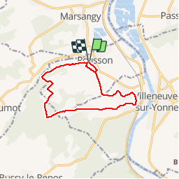

Length
12 km

Max alt
198 m

Uphill gradient
197 m
Km-Effort
14.7 km

Min alt
84 m

Downhill gradient
196 m
Boucle
Yes
Creation date :
2018-06-26 15:56:31.64
Updated on :
2018-06-26 15:56:31.64
4h33
Difficulty : Unknown

FREE GPS app for hiking
 SityTrail
IGN / Geographical institutes
SityTrail Plus
The world is yours!
About
Trail Walking of 12 km to be discovered at Bourgogne-Franche-Comté, Yonne, Rousson. This trail is proposed by randodan.
Photos


Positioning
Country:
France
Region :
Bourgogne-Franche-Comté
Department/Province :
Yonne
Municipality :
Rousson
Location:
Unknown
Start:(Dec)
Start:(UTM)
519431 ; 5326911 (31U) N.
Comments