


chamechaude

gsouque
User

Length
27 km

Max alt
2034 m

Uphill gradient
1791 m
Km-Effort
51 km

Min alt
800 m

Downhill gradient
1793 m
Boucle
Yes
Creation date :
2018-06-26 16:25:40.821
Updated on :
2018-06-26 16:25:40.821
--
Difficulty : Unknown

FREE GPS app for hiking
 SityTrail
IGN / Geographical institutes
SityTrail Plus
The world is yours!
About
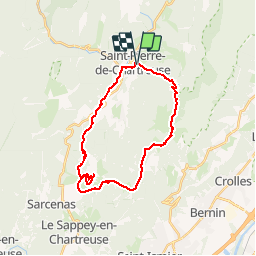
Trail Running of 27 km to be discovered at Auvergne-Rhône-Alpes, Isère, Saint-Pierre-de-Chartreuse. This trail is proposed by gsouque.
Positioning
Country:
France
Region :
Auvergne-Rhône-Alpes
Department/Province :
Isère
Municipality :
Saint-Pierre-de-Chartreuse
Location:
Unknown
Start:(Dec)
Start:(UTM)
720765 ; 5024706 (31T) N.
Comments