


180615

randodan
User
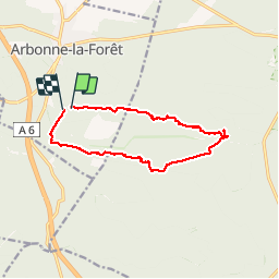

Length
11.4 km

Max alt
132 m

Uphill gradient
123 m
Km-Effort
13 km

Min alt
73 m

Downhill gradient
129 m
Boucle
Yes
Creation date :
2018-06-26 16:33:36.684
Updated on :
2018-06-26 16:33:36.684
5h17
Difficulty : Unknown

FREE GPS app for hiking
 SityTrail
IGN / Geographical institutes
SityTrail Plus
The world is yours!
About
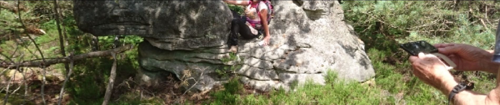
Trail Walking of 11.4 km to be discovered at Ile-de-France, Seine-et-Marne, Arbonne-la-Forêt. This trail is proposed by randodan.
Photos


Positioning
Country:
France
Region :
Ile-de-France
Department/Province :
Seine-et-Marne
Municipality :
Arbonne-la-Forêt
Location:
Unknown
Start:(Dec)
Start:(UTM)
468045 ; 5360827 (31U) N.
Comments