Trail Walking Montgiscard - 18 Juin 2018 - Photo
 FLOCON
FLOCON

User

© OpenStreetMap contributors
Length
Length
9.9 km
Max alt
Max alt
278 m
Uphill gradient
Uphill gradient
203 m
Km-Effort
Km-Effort  
12.6 km
Min alt
Min alt
172 m
Downhill gradient
Downhill gradient
203 m
Boucle
Boucle
Yes
Creation date :
2018-06-26 16:36:19.936
Updated on :
2018-06-26 16:36:19.936

(0 Reviews)

Walking
Walking
2h19
Difficulty : Medium

Scan this QR Code to open this trail in the SityTrail application

FREE GPS app for hiking

Logo SityTrail SityTrail

IGN / Geographical institutes

Download SityTrail from the App Store Download SityTrail from Google Play

Logo SityTrail SityTrail World

The world is yours!

Download SityTrail from the App Store Download SityTrail from Google Play Download SityTrail on Huawei AppGallery

About

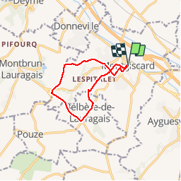
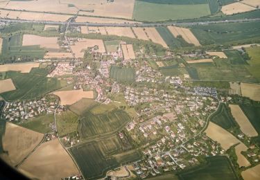
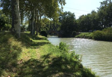
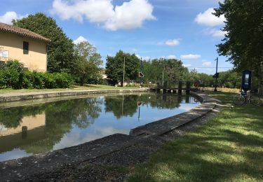
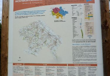
Trail Walking of 9.9 km to be discovered at Occitania, Haute-Garonne, Montgiscard. This trail is proposed by FLOCON.

Description

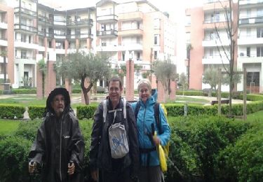
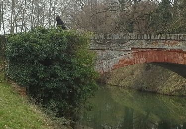
MONTGISCARD. APRES L'APPEL CELEBRE  22 COMBATTANTS, MARCHE COMMANDO VERS UN SEUL BUT REPRENDRE DU TERRAIN TEMPS AGREABLE

Elevation profile

Positioning

Country:
France
Region :
Occitania
Department/Province :
Haute-Garonne
Municipality :
Montgiscard
Location:
Unknown
Start:(UTM)
384680 ; 4812638 (31T) N.

Trails nearby

Trail Roller skating Deyme - Rollers - pont canal Pompertuzat -> Super U Belberaud -> Église Escalquens -> Montlaur-> pont canal Montlaur - Photo
Roller skating
LoulouteRollers

Roller skating

Difficult
(1)
Deyme, Occitania, Haute-Garonne, France
20 km | 23 km-effort
2h 0min
Yes
Trail On foot Donneville - Boucle de Saint-Ignace - Photo
On foot
PRO

On foot

Easy
Donneville, Occitania, Haute-Garonne, France
4.1 km | 5.7 km-effort
1h 17min
Yes
Trail Walking Ayguesvives - Montgiscard  - Photo
Walking
richardsimopons

Walking

Ayguesvives, Occitania, Haute-Garonne, France
7.3 km | 8.3 km-effort
1h 45min
Yes
Trail Walking Ayguesvives - Canal du midi 31719 - Photo
Walking
richardsimopons

Walking

Ayguesvives, Occitania, Haute-Garonne, France
11.4 km | 12.6 km-effort
2h 42min
No
Trail Walking Donneville - Donneville -Toulouse - Photo
Walking
RR31

Walking

Medium
Donneville, Occitania, Haute-Garonne, France
31 km | 34 km-effort
Unknown
No
Trail Walking Montlaur - 23 février 2021 - Photo
Walking
arnoultjf

Walking

Very easy
Montlaur, Occitania, Haute-Garonne, France
10.4 km | 11.8 km-effort
2h 5min
No
Trail Walking Montgiscard - Montgiscard ÷Villenouvelle - Photo
Walking
RR31

Walking

Medium
Montgiscard, Occitania, Haute-Garonne, France
25 km | 28 km-effort
5h 58min
Yes
Trail Walking Montbrun-Lauragais - De Montbrun Lauragais au Canal du Midi - Photo
Walking
tracegps

Walking

Medium
Montbrun-Lauragais, Occitania, Haute-Garonne, France
14 km | 17.8 km-effort
4h 0min
Yes
Trail Walking Ayguesvives - Canal du Midi - Ecluse du Sanglier - Ecluse de Laval - Photo
Walking
tracegps

Walking

Easy
Ayguesvives, Occitania, Haute-Garonne, France
7.9 km | 8.6 km-effort
1h 30min
No


Close
My subscriptions