


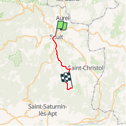
GR4-J02 - Sault - Les Esfourniaux

nfranche
User

Length
18 km

Max alt
1114 m

Uphill gradient
716 m
Km-Effort
26 km

Min alt
693 m

Downhill gradient
358 m
Boucle
No
Creation date :
2019-01-15 12:14:08.984
Updated on :
2019-01-15 12:14:08.984
5h43
Difficulty : Difficult

FREE GPS app for hiking
 SityTrail
IGN / Geographical institutes
SityTrail Plus
The world is yours!
About
Trail Walking of 18 km to be discovered at Provence-Alpes-Côte d'Azur, Vaucluse, Sault. This trail is proposed by nfranche.
Positioning
Country:
France
Region :
Provence-Alpes-Côte d'Azur
Department/Province :
Vaucluse
Municipality :
Sault
Location:
Unknown
Start:(Dec)
Start:(UTM)
692744 ; 4884780 (31T) N.
Comments