


03 BastidePuylaurent-Finiels

nicolas54230
User
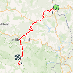

Length
45 km

Max alt
1699 m

Uphill gradient
1562 m
Km-Effort
65 km

Min alt
1032 m

Downhill gradient
1372 m
Boucle
No
Creation date :
2019-01-15 12:32:47.408
Updated on :
2019-01-15 12:32:47.408
4h10
Difficulty : Difficult

FREE GPS app for hiking
 SityTrail
IGN / Geographical institutes
SityTrail Plus
The world is yours!
About
Trail Mountain bike of 45 km to be discovered at Occitania, Lozère, La Bastide-Puylaurent. This trail is proposed by nicolas54230.
Positioning
Country:
France
Region :
Occitania
Department/Province :
Lozère
Municipality :
La Bastide-Puylaurent
Location:
Unknown
Start:(Dec)
Start:(UTM)
570901 ; 4936199 (31T) N.
Comments