


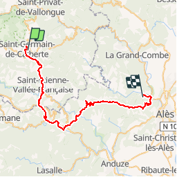
06 St Germain de Calberte-Alès

nicolas54230
User

Length
47 km

Max alt
667 m

Uphill gradient
1677 m
Km-Effort
70 km

Min alt
151 m

Downhill gradient
1928 m
Boucle
No
Creation date :
2019-01-15 12:33:04.526
Updated on :
2019-01-15 12:33:04.526
4h25
Difficulty : Difficult

FREE GPS app for hiking
 SityTrail
IGN / Geographical institutes
SityTrail Plus
The world is yours!
About
Trail Mountain bike of 47 km to be discovered at Occitania, Lozère, Saint-Germain-de-Calberte. This trail is proposed by nicolas54230.
Positioning
Country:
France
Region :
Occitania
Department/Province :
Lozère
Municipality :
Saint-Germain-de-Calberte
Location:
Unknown
Start:(Dec)
Start:(UTM)
564888 ; 4896204 (31T) N.
Comments