


4,7 km | 7,4 km-effort
Hauts de Bienne: Descubra las mejores excursiones: 19 a pie y 4 en bici o bici de montaña. Todos estos circuitos, recorridos, itinerarios y actividades al aire libre están disponibles en nuestras aplicaciones SityTrail para smartphone y tablet.
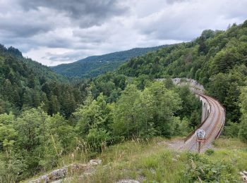
Senderismo


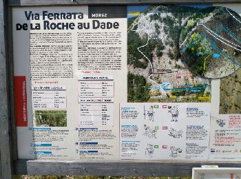
Vía ferrata
• via
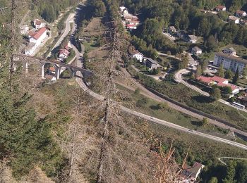
Senderismo

Cicloturismo

Senderismo
Bicicleta

Carrera
Senderismo
Senderismo
Senderismo
Senderismo
Senderismo
Senderismo
Senderismo
Senderismo
Senderismo
Senderismo

 38.132
sport
Bici eléctrica
Senderismo
20 excursiones mostradas en 26
Aplicación GPS de excursión GRATIS
 SityTrail
IGN / Institutos geográficos
SityTrail World
El mundo es suyo