![](/images/other/stat-length.png)
![Excursión Senderismo Grande-Rivière-Château - GR_559_AE_05_Grande-Riviere-Chateau_Hauts-Bienne_20210918 - Photo](https://media.geolcdn.com/t/1900/400/ext.pjpeg?maxdim=2&url=https%3A%2F%2Fmedia.geolcdn.com%2Ff%2Fb44a5ba8-0849-49ca-a679-16c23ca25abe.jpg)
GR_559_AE_05_Grande-Riviere-Chateau_Hauts-Bienne_20210918
patrickdanilo
Usuario
![Longitud](/images/other/stat-length.png)
Longitud
11,9 km
![Altitud máxima](https://static1.geolcdn.com/siteimages/upload/files/1508320355ic_sort_altitude_max_24dp.png)
Altitud máxima
1109 m
![Desnivel positivo](https://static1.geolcdn.com/siteimages/upload/files/1508320355ic_sort_den_pos_24dp.png)
Desnivel positivo
552 m
![Km-Effort](/images/other/stat-length.png)
Km-Effort
19,2 km
![Altitud mínima](https://static1.geolcdn.com/siteimages/upload/files/1508320355ic_sort_altitude_min_24dp.png)
Altitud mínima
622 m
![Desnivel negativo](https://static1.geolcdn.com/siteimages/upload/files/1508320355ic_sort_den_neg_24dp.png)
Desnivel negativo
516 m
![Boucle](https://static1.geolcdn.com/siteimages/upload/files/16400158638029165_repeat_loop_refresh_sync_direction_icon.png)
Boucle
No
Fecha de creación :
2021-09-18 08:01:01.775
Última modificación :
2022-02-09 10:47:57.686
![Senderismo](https://static1.geolcdn.com/sitytour/trail-icons/101.png)
4h05
Dificultad : Muy difícil
![Escanee este código QR para abrir la excursión en la aplicación SityTrail](https://capi.geolives.com/qq0zvz2zws4bq2lad0pu/sitytour/trails/2940382/qr.png?size=200)
Aplicación GPS de excursión GRATIS
A propósito
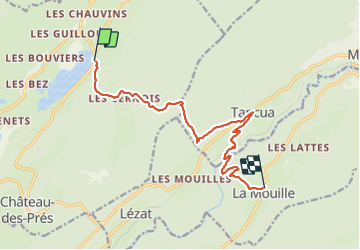
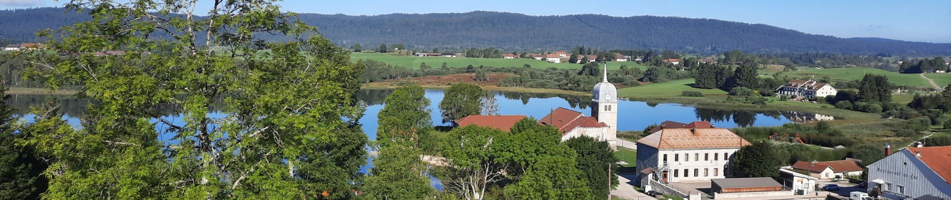
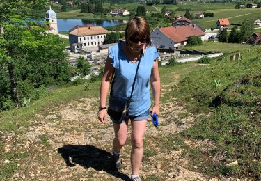
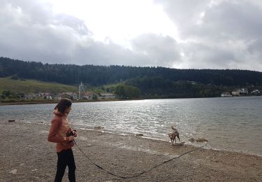
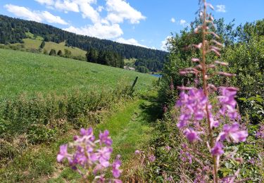
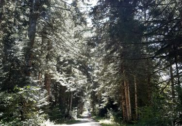
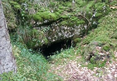
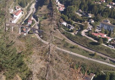
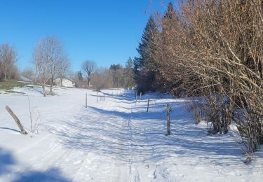
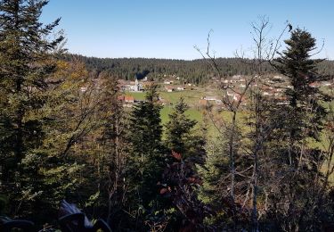
Ruta Senderismo de 11,9 km a descubrir en Borgoña-Franco Condado, Jura, Grande-Rivière-Château. Esta ruta ha sido propuesta por patrickdanilo.
Descripción
GR®559
Le Jura d'Ouest en Est
de Montaigu (Jura) Bourgogne-Franche-Comté
aux Rousses (Jura) Bourgogne-Franche-Comté
82,8km
Localización
País:
France
Región :
Borgoña-Franco Condado
Departamento/provincia :
Jura
Municipio :
Grande-Rivière-Château
Localidad:
Grande-Rivière
Salida:(Dec)
Salida:(UTM)
724033 ; 5157626 (31T) N.
Comentarios
Excursiones cerca
![Excursión Senderismo Grande-Rivière-Château - Tour du lac et belvédère du moulin - Photo](https://media.geolcdn.com/t/375/260/ext.jpg?maxdim=2&url=https%3A%2F%2Fmedia.geolcdn.com%2Ff%2Fb0dd3851-bef5-4610-8f30-cc492fe52829.jpg)
![Senderismo Senderismo](https://static1.geolcdn.com/sitytour/trail-icons/101.png)
Tour du lac et belvédère du moulin
Senderismo
(1)
Grande-Rivière-Château,
Borgoña-Franco Condado,
Jura,
France
![](/images/other/stat-length.png)
10,5 km | 13,9 km-effort
2h 58min
![](https://static1.geolcdn.com/siteimages/upload/files/16400158638029165_repeat_loop_refresh_sync_direction_icon.png)
Sí
![Excursión Ruta Grande-Rivière-Château - Lac Abbaye - Photo](https://media.geolcdn.com/t/375/260/ext.jpg?maxdim=2&url=https%3A%2F%2Fstatic1.geolcdn.com%2Fsiteimages%2Fupload%2Ffiles%2F1524743154running.jpg)
![Ruta Ruta](https://static1.geolcdn.com/sitytour/trail-icons/104.png)
Lac Abbaye
Ruta
Muy fácil
(1)
Grande-Rivière-Château,
Borgoña-Franco Condado,
Jura,
France
![](/images/other/stat-length.png)
10,6 km | 14,1 km-effort
1h 30min
![](https://static1.geolcdn.com/siteimages/upload/files/16400158638029165_repeat_loop_refresh_sync_direction_icon.png)
Sí
![Excursión Senderismo Grande-Rivière-Château - Lac de l'Abbaye - Photo](https://media.geolcdn.com/t/375/260/ext.jpg?maxdim=2&url=https%3A%2F%2Fmedia.geolcdn.com%2Ff%2Fa2594360-93e1-460f-abd3-860566bb1620.jpg)
![Senderismo Senderismo](https://static1.geolcdn.com/sitytour/trail-icons/101.png)
Lac de l'Abbaye
Senderismo
Muy fácil
Grande-Rivière-Château,
Borgoña-Franco Condado,
Jura,
France
![](/images/other/stat-length.png)
7 km | 8,2 km-effort
1h 32min
![](https://static1.geolcdn.com/siteimages/upload/files/16400158638029165_repeat_loop_refresh_sync_direction_icon.png)
Sí
![Excursión Senderismo Grande-Rivière-Château - Tour du Lac de l'Abbaye de Grandvaux - Photo](https://media.geolcdn.com/t/375/260/ext.jpg?maxdim=2&url=https%3A%2F%2Fmedia.geolcdn.com%2Ff%2F6b08476a-2c28-44bd-8450-eae60772b462.jpg)
![Senderismo Senderismo](https://static1.geolcdn.com/sitytour/trail-icons/101.png)
Tour du Lac de l'Abbaye de Grandvaux
Senderismo
Fácil
Grande-Rivière-Château,
Borgoña-Franco Condado,
Jura,
France
![](/images/other/stat-length.png)
7,9 km | 9,1 km-effort
2h 27min
![](https://static1.geolcdn.com/siteimages/upload/files/16400158638029165_repeat_loop_refresh_sync_direction_icon.png)
No
![Excursión Senderismo Grande-Rivière-Château - chaux des pres - Photo](https://media.geolcdn.com/t/375/260/ext.jpg?maxdim=2&url=https%3A%2F%2Fmedia.geolcdn.com%2Ff%2F985a43f6-f428-42ac-9d88-8e6195a5d681.jpg)
![Senderismo Senderismo](https://static1.geolcdn.com/sitytour/trail-icons/101.png)
chaux des pres
Senderismo
Muy fácil
Grande-Rivière-Château,
Borgoña-Franco Condado,
Jura,
France
![](/images/other/stat-length.png)
12,7 km | 16,2 km-effort
6h 20min
![](https://static1.geolcdn.com/siteimages/upload/files/16400158638029165_repeat_loop_refresh_sync_direction_icon.png)
No
![Excursión Senderismo Saint-Laurent-en-Grandvaux - Saint Laurent - Abbaye Grandsvaux - Photo](https://media.geolcdn.com/t/375/260/ext.jpg?maxdim=2&url=https%3A%2F%2Fservices.sitytrail.com%2FGeolivesWS%2FDownloadMedia.ashx%3FTrailID%3D650502%26Media%3Dfix__20161024145845.jpg)
![Senderismo Senderismo](https://static1.geolcdn.com/sitytour/trail-icons/101.png)
Saint Laurent - Abbaye Grandsvaux
Senderismo
Fácil
Saint-Laurent-en-Grandvaux,
Borgoña-Franco Condado,
Jura,
France
![](/images/other/stat-length.png)
14,4 km | 20 km-effort
3h 13min
![](https://static1.geolcdn.com/siteimages/upload/files/16400158638029165_repeat_loop_refresh_sync_direction_icon.png)
Sí
![Excursión Senderismo Hauts de Bienne - La Mouile -Morez - Photo](https://media.geolcdn.com/t/375/260/ext.jpg?maxdim=2&url=https%3A%2F%2Fmedia.geolcdn.com%2Ff%2F5602c40d-f47e-442c-98f2-0981ace2bf41.jpg)
![Senderismo Senderismo](https://static1.geolcdn.com/sitytour/trail-icons/101.png)
La Mouile -Morez
Senderismo
Medio
Hauts de Bienne,
Borgoña-Franco Condado,
Jura,
France
![](/images/other/stat-length.png)
15,4 km | 23 km-effort
3h 42min
![](https://static1.geolcdn.com/siteimages/upload/files/16400158638029165_repeat_loop_refresh_sync_direction_icon.png)
Sí
![Excursión Senderismo Saint-Laurent-en-Grandvaux - St Laurent en grandvaux le marechet - Photo](https://media.geolcdn.com/t/375/260/ext.jpg?maxdim=2&url=https%3A%2F%2Fmedia.geolcdn.com%2Ff%2F6924984c-0403-4a29-8d11-05bd5f7e9166.jpg)
![Senderismo Senderismo](https://static1.geolcdn.com/sitytour/trail-icons/101.png)
St Laurent en grandvaux le marechet
Senderismo
Medio
Saint-Laurent-en-Grandvaux,
Borgoña-Franco Condado,
Jura,
France
![](/images/other/stat-length.png)
17,6 km | 22 km-effort
4h 18min
![](https://static1.geolcdn.com/siteimages/upload/files/16400158638029165_repeat_loop_refresh_sync_direction_icon.png)
Sí
![Excursión Senderismo Grande-Rivière-Château - Prenovel:tour - Photo](https://media.geolcdn.com/t/375/260/ext.jpg?maxdim=2&url=https%3A%2F%2Fmedia.geolcdn.com%2Ff%2F70c5087d-c845-4405-b6b2-413a62af925f.jpg)
![Senderismo Senderismo](https://static1.geolcdn.com/sitytour/trail-icons/101.png)
Prenovel:tour
Senderismo
Medio
Grande-Rivière-Château,
Borgoña-Franco Condado,
Jura,
France
![](/images/other/stat-length.png)
16,8 km | 23 km-effort
4h 34min
![](https://static1.geolcdn.com/siteimages/upload/files/16400158638029165_repeat_loop_refresh_sync_direction_icon.png)
Sí