![](/images/other/stat-length.png)
![Excursión Senderismo Sombreffe - Marche Adeps à Tongrinne - Sombreffe - Photo](https://media.geolcdn.com/t/1900/400/ext.pjpeg?maxdim=2&url=https%3A%2F%2Fmedia.geolcdn.com%2Ff%2F58790356-bb4c-4aa2-b69b-43a492b28054.jpeg)
Marche Adeps à Tongrinne - Sombreffe
Desrumaux
Usuario GUIDE
![Longitud](/images/other/stat-length.png)
Longitud
11,3 km
![Altitud máxima](https://static1.geolcdn.com/siteimages/upload/files/1508320355ic_sort_altitude_max_24dp.png)
Altitud máxima
165 m
![Desnivel positivo](https://static1.geolcdn.com/siteimages/upload/files/1508320355ic_sort_den_pos_24dp.png)
Desnivel positivo
137 m
![Km-Effort](/images/other/stat-length.png)
Km-Effort
13,2 km
![Altitud mínima](https://static1.geolcdn.com/siteimages/upload/files/1508320355ic_sort_altitude_min_24dp.png)
Altitud mínima
119 m
![Desnivel negativo](https://static1.geolcdn.com/siteimages/upload/files/1508320355ic_sort_den_neg_24dp.png)
Desnivel negativo
143 m
![Boucle](https://static1.geolcdn.com/siteimages/upload/files/16400158638029165_repeat_loop_refresh_sync_direction_icon.png)
Boucle
Sí
Fecha de creación :
2023-04-30 08:51:23.829
Última modificación :
2024-04-25 16:19:07.365
![Senderismo](https://static1.geolcdn.com/sitytour/trail-icons/101.png)
2h59
Dificultad : Difícil
![Escanee este código QR para abrir la excursión en la aplicación SityTrail](https://capi.geolives.com/qq0zvz2zws4bq2lad0pu/sitytour/trails/3641237/qr.png?size=200)
Aplicación GPS de excursión GRATIS
A propósito
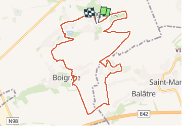
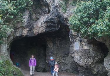
Ruta Senderismo de 11,3 km a descubrir en Valonia, Namur, Sombreffe. Esta ruta ha sido propuesta por Desrumaux.
Descripción
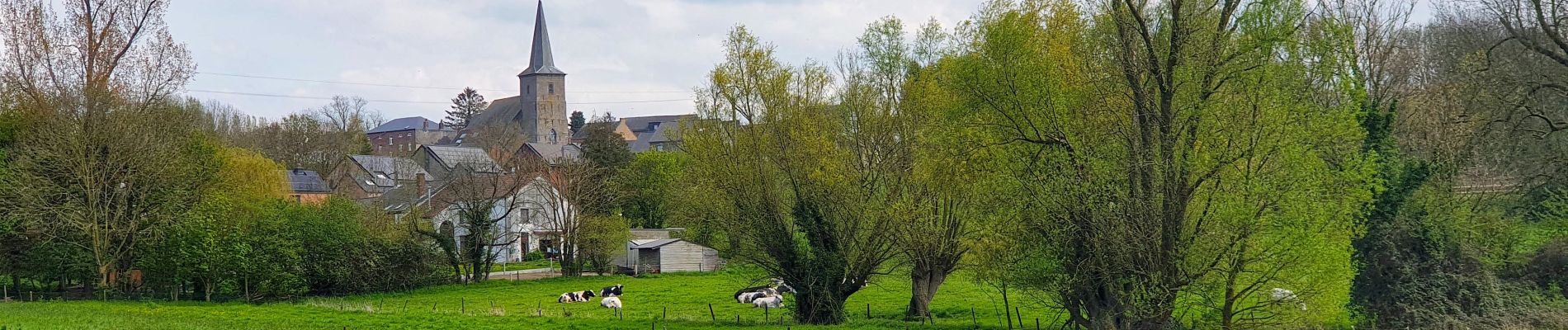
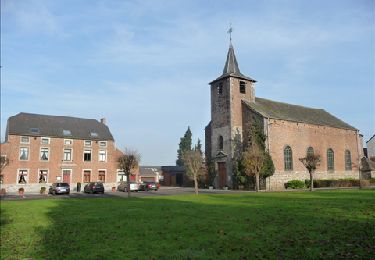
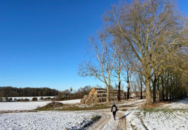
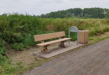
Jolie balade dans la belle campagne de l'entité de Sombreffe au départ du village de Tongrinne vers le village de Boignée.
Départ: rue Maréchal juin école communal ou église de Tongrinne.
Localización
País:
Belgium
Región :
Valonia
Departamento/provincia :
Namur
Municipio :
Sombreffe
Localidad:
Unknown
Salida:(Dec)
Salida:(UTM)
615055 ; 5597000 (31U) N.
Comentarios
Excursiones cerca
![Excursión Senderismo Jemeppe-sur-Sambre - RF-Na-01-Onoz_Petite-boucle - Photo](https://media.geolcdn.com/t/375/260/ext.jpg?maxdim=2&url=https%3A%2F%2Fservices.sitytrail.com%2FGeolivesWS%2FDownloadMedia.ashx%3FTrailID%3D545735%26Media%3Df68c7b52-4432-4018-b01d-0bb04e06ad16.jpg)
![Senderismo Senderismo](https://static1.geolcdn.com/sitytour/trail-icons/101.png)
RF-Na-01-Onoz_Petite-boucle
Senderismo
Fácil
(10)
Jemeppe-sur-Sambre,
Valonia,
Namur,
Belgium
![](/images/other/stat-length.png)
7,4 km | 8,9 km-effort
1h 59min
![](https://static1.geolcdn.com/siteimages/upload/files/16400158638029165_repeat_loop_refresh_sync_direction_icon.png)
Sí
![Excursión Senderismo Jemeppe-sur-Sambre - De Balâtre à Tongrinne par la vallée de la Ligne - Photo](https://media.geolcdn.com/t/375/260/ext.jpg?maxdim=2&url=https%3A%2F%2Fservices.sitytrail.com%2FGeolivesWS%2FDownloadMedia.ashx%3FTrailID%3D95534%26Media%3De2db5dc2-0ab1-4cda-b9fd-3c87611cc9a3.jpg)
![Senderismo Senderismo](https://static1.geolcdn.com/sitytour/trail-icons/101.png)
De Balâtre à Tongrinne par la vallée de la Ligne
Senderismo
Fácil
(1)
Jemeppe-sur-Sambre,
Valonia,
Namur,
Belgium
![](/images/other/stat-length.png)
12,9 km | 15,4 km-effort
3h 0min
![](https://static1.geolcdn.com/siteimages/upload/files/16400158638029165_repeat_loop_refresh_sync_direction_icon.png)
Sí
![Excursión Senderismo Jemeppe-sur-Sambre - La petite boucle de Onoz - Photo](https://media.geolcdn.com/t/375/260/ext.jpg?maxdim=2&url=https%3A%2F%2Fmedia.geolcdn.com%2Ff%2F728a8926-dea5-48ea-8a91-8a3e4029625e.jpg)
![Senderismo Senderismo](https://static1.geolcdn.com/sitytour/trail-icons/101.png)
La petite boucle de Onoz
Senderismo
Fácil
(3)
Jemeppe-sur-Sambre,
Valonia,
Namur,
Belgium
![](/images/other/stat-length.png)
7 km | 8,4 km-effort
1h 57min
![](https://static1.geolcdn.com/siteimages/upload/files/16400158638029165_repeat_loop_refresh_sync_direction_icon.png)
Sí
![Excursión Senderismo Jemeppe-sur-Sambre - RF-Na-01-Onoz_Grande-boucle - Photo](https://media.geolcdn.com/t/375/260/ext.jpg?maxdim=2&url=https%3A%2F%2Fservices.sitytrail.com%2FGeolivesWS%2FDownloadMedia.ashx%3FTrailID%3D545736%26Media%3Dca5596bc-2473-4f40-bb0a-21932020469e.jpg)
![Senderismo Senderismo](https://static1.geolcdn.com/sitytour/trail-icons/101.png)
RF-Na-01-Onoz_Grande-boucle
Senderismo
Medio
(7)
Jemeppe-sur-Sambre,
Valonia,
Namur,
Belgium
![](/images/other/stat-length.png)
8,8 km | 10,5 km-effort
2h 19min
![](https://static1.geolcdn.com/siteimages/upload/files/16400158638029165_repeat_loop_refresh_sync_direction_icon.png)
Sí
![Excursión Bici de montaña Jemeppe-sur-Sambre - O2bikers_126_spy - Photo](https://media.geolcdn.com/t/375/260/ext.jpg?maxdim=2&url=https%3A%2F%2Fstatic1.geolcdn.com%2Fsiteimages%2Fupload%2Ffiles%2F1524743154velo.jpg)
![Bici de montaña Bici de montaña](https://static1.geolcdn.com/sitytour/trail-icons/202.png)
O2bikers_126_spy
Bici de montaña
Muy fácil
(3)
Jemeppe-sur-Sambre,
Valonia,
Namur,
Belgium
![](/images/other/stat-length.png)
32 km | 39 km-effort
5h 19min
![](https://static1.geolcdn.com/siteimages/upload/files/16400158638029165_repeat_loop_refresh_sync_direction_icon.png)
Sí
![Excursión A pie Jemeppe-sur-Sambre - Cirkwi-Sur_les_traces_de_l_Homme_de_Spy_-_tour_complet - Photo](https://media.geolcdn.com/t/375/260/ext.jpg?maxdim=2&url=https%3A%2F%2Fmedia.geolcdn.com%2Ff%2F0d4612b7-1403-4944-8642-8449664fec59.jpeg)
![A pie A pie](https://static1.geolcdn.com/sitytour/trail-icons/100.png)
Cirkwi-Sur_les_traces_de_l_Homme_de_Spy_-_tour_complet
A pie
Fácil
(1)
Jemeppe-sur-Sambre,
Valonia,
Namur,
Belgium
![](/images/other/stat-length.png)
3,5 km | 4,7 km-effort
1h 3min
![](https://static1.geolcdn.com/siteimages/upload/files/16400158638029165_repeat_loop_refresh_sync_direction_icon.png)
Sí
![Excursión Senderismo Jemeppe-sur-Sambre - SNS 8 ONOZ 010321 - Photo](https://media.geolcdn.com/t/375/260/ext.jpg?maxdim=2&url=https%3A%2F%2Fstatic1.geolcdn.com%2Fsiteimages%2Fupload%2Ffiles%2F1553511878bg_sport_marche.png)
![Senderismo Senderismo](https://static1.geolcdn.com/sitytour/trail-icons/101.png)
SNS 8 ONOZ 010321
Senderismo
Medio
(1)
Jemeppe-sur-Sambre,
Valonia,
Namur,
Belgium
![](/images/other/stat-length.png)
8,1 km | 9,5 km-effort
2h 4min
![](https://static1.geolcdn.com/siteimages/upload/files/16400158638029165_repeat_loop_refresh_sync_direction_icon.png)
Sí
![Excursión Senderismo Sombreffe - Balade de Ligny à Sombreffe - Photo](https://media.geolcdn.com/t/375/260/ext.jpg?maxdim=2&url=https%3A%2F%2Fmedia.geolcdn.com%2Ff%2Ff0db729a-c8a9-4834-9f55-b6a3b0909aa6.jpg)
![Senderismo Senderismo](https://static1.geolcdn.com/sitytour/trail-icons/101.png)
Balade de Ligny à Sombreffe
Senderismo
Muy fácil
(1)
Sombreffe,
Valonia,
Namur,
Belgium
![](/images/other/stat-length.png)
9,3 km | 10,4 km-effort
4h 27min
![](https://static1.geolcdn.com/siteimages/upload/files/16400158638029165_repeat_loop_refresh_sync_direction_icon.png)
Sí
![Excursión Senderismo Jemeppe-sur-Sambre - BALADRE _ Salle Communale de Baladre_ Place communale _ 5190 -Baladre - Photo](https://media.geolcdn.com/t/375/260/ext.jpg?maxdim=2&url=https%3A%2F%2Fstatic1.geolcdn.com%2Fsiteimages%2Fupload%2Ffiles%2F1553511878bg_sport_marche.png)
![Senderismo Senderismo](https://static1.geolcdn.com/sitytour/trail-icons/101.png)
BALADRE _ Salle Communale de Baladre_ Place communale _ 5190 -Baladre
Senderismo
Medio
(1)
Jemeppe-sur-Sambre,
Valonia,
Namur,
Belgium
![](/images/other/stat-length.png)
13,1 km | 15,5 km-effort
3h 27min
![](https://static1.geolcdn.com/siteimages/upload/files/16400158638029165_repeat_loop_refresh_sync_direction_icon.png)
Sí