![](/images/other/stat-length.png)
![Excursión Senderismo Serres - gogo1965 - Photo](https://media.geolcdn.com/t/1900/400/ext.pjpeg?maxdim=2&url=https%3A%2F%2Fmedia.geolcdn.com%2Ff%2F2c2ad03e-8680-4903-b90a-a34f9c6cb5bc.jpg)
gogo1965
gogo1965
Usuario
![Longitud](/images/other/stat-length.png)
Longitud
8,5 km
![Altitud máxima](https://static1.geolcdn.com/siteimages/upload/files/1508320355ic_sort_altitude_max_24dp.png)
Altitud máxima
426 m
![Desnivel positivo](https://static1.geolcdn.com/siteimages/upload/files/1508320355ic_sort_den_pos_24dp.png)
Desnivel positivo
242 m
![Km-Effort](/images/other/stat-length.png)
Km-Effort
11,7 km
![Altitud mínima](https://static1.geolcdn.com/siteimages/upload/files/1508320355ic_sort_altitude_min_24dp.png)
Altitud mínima
270 m
![Desnivel negativo](https://static1.geolcdn.com/siteimages/upload/files/1508320355ic_sort_den_neg_24dp.png)
Desnivel negativo
244 m
![Boucle](https://static1.geolcdn.com/siteimages/upload/files/16400158638029165_repeat_loop_refresh_sync_direction_icon.png)
Boucle
Sí
Fecha de creación :
2023-09-19 10:48:41.737
Última modificación :
2023-09-19 17:16:28.061
![Senderismo](https://static1.geolcdn.com/sitytour/trail-icons/101.png)
2h07
Dificultad : Medio
![Escanee este código QR para abrir la excursión en la aplicación SityTrail](https://capi.geolives.com/qq0zvz2zws4bq2lad0pu/sitytour/trails/3812027/qr.png?size=200)
Aplicación GPS de excursión GRATIS
A propósito
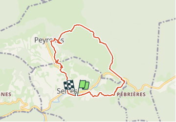
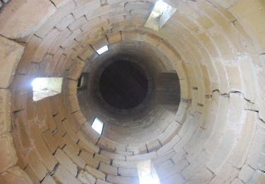
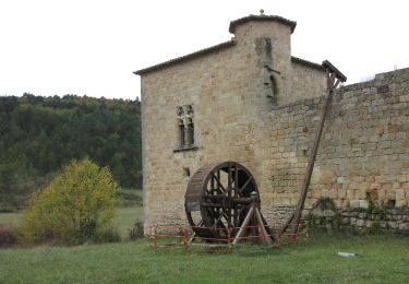
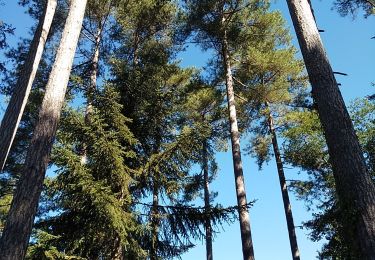
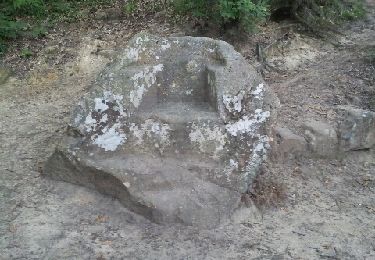
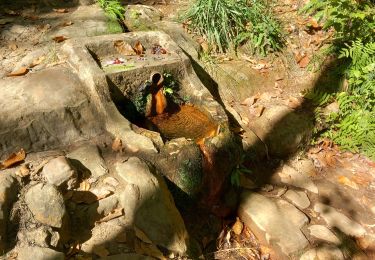
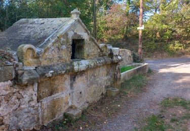
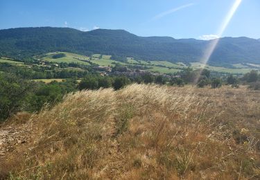
Ruta Senderismo de 8,5 km a descubrir en Occitania, Aude, Serres. Esta ruta ha sido propuesta por gogo1965.
Descripción
une promenade superbe des vues incroyables maïs á la fin pas très claire marqué maïs vraiment une promenade á faire
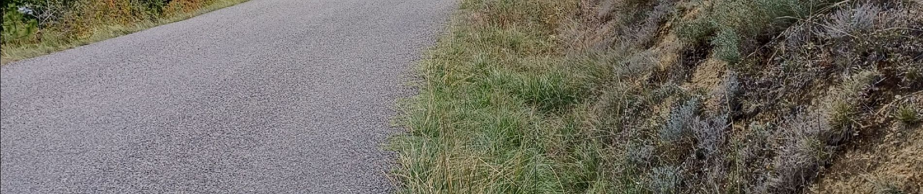
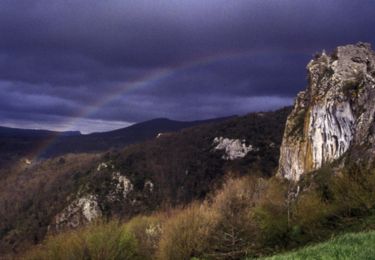
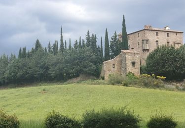
Localización
País:
France
Región :
Occitania
Departamento/provincia :
Aude
Municipio :
Serres
Localidad:
Unknown
Salida:(Dec)
Salida:(UTM)
445124 ; 4754958 (31T) N.
Comentarios
Excursiones cerca
![Excursión Bicicleta Arques - CCS FFC Aude en Pyrénées - Circuit n°11 - Arques - Photo](https://media.geolcdn.com/t/375/260/ext.jpg?maxdim=2&url=https%3A%2F%2Fservices.sitytrail.com%2FGeolivesWS%2FDownloadMedia.ashx%3FTrailID%3D111470%26Media%3D7353_1.jpg)
![Bicicleta Bicicleta](https://static1.geolcdn.com/sitytour/trail-icons/200.png)
CCS FFC Aude en Pyrénées - Circuit n°11 - Arques
Bicicleta
Difícil
(1)
Arques,
Occitania,
Aude,
France
![](/images/other/stat-length.png)
47 km | 60 km-effort
2h 30min
![](https://static1.geolcdn.com/siteimages/upload/files/16400158638029165_repeat_loop_refresh_sync_direction_icon.png)
Sí
![Excursión Senderismo Serres - Serres Cardou - Photo](https://media.geolcdn.com/t/375/260/ext.jpg?maxdim=2&url=https%3A%2F%2Fmedia.geolcdn.com%2Ff%2F3dcdcfad-e675-4328-969d-93b02c6e2d21.jpg)
![Senderismo Senderismo](https://static1.geolcdn.com/sitytour/trail-icons/101.png)
![Excursión A pie Arques - La Frau - Photo](https://media.geolcdn.com/t/375/260/ext.jpg?maxdim=2&url=https%3A%2F%2Fmedia.geolcdn.com%2Ff%2Fdd7678c6-a794-444d-a52c-e2d60c9d9291.jpeg)
![A pie A pie](https://static1.geolcdn.com/sitytour/trail-icons/100.png)
![Excursión A pie Arques - Les Berques - Photo](https://media.geolcdn.com/t/375/260/ext.jpg?maxdim=2&url=https%3A%2F%2Fmedia.geolcdn.com%2Ff%2F84344748-6b6d-47a0-bbe7-d97839fec542.jpeg)
![A pie A pie](https://static1.geolcdn.com/sitytour/trail-icons/100.png)
![Excursión Senderismo Arques - Arques 29 09 3019 - Photo](https://media.geolcdn.com/t/375/260/ext.jpg?maxdim=2&url=https%3A%2F%2Fmedia.geolcdn.com%2Ff%2Fd8261a14-6ebe-438a-a45c-071567d1fc57.jpg)
![Senderismo Senderismo](https://static1.geolcdn.com/sitytour/trail-icons/101.png)
Arques 29 09 3019
Senderismo
Muy fácil
(2)
Arques,
Occitania,
Aude,
France
![](/images/other/stat-length.png)
8,6 km | 11,3 km-effort
3h 21min
![](https://static1.geolcdn.com/siteimages/upload/files/16400158638029165_repeat_loop_refresh_sync_direction_icon.png)
Sí
![Excursión Senderismo Rennes-les-Bains - Sources Rennes les bains - Photo](https://media.geolcdn.com/t/375/260/ext.jpg?maxdim=2&url=https%3A%2F%2Fservices.sitytrail.com%2FGeolivesWS%2FDownloadMedia.ashx%3FTrailID%3D139042%26Media%3D20120625205934.jpeg)
![Senderismo Senderismo](https://static1.geolcdn.com/sitytour/trail-icons/101.png)
Sources Rennes les bains
Senderismo
Medio
(2)
Rennes-les-Bains,
Occitania,
Aude,
France
![](/images/other/stat-length.png)
5,8 km | 8,7 km-effort
3h 5min
![](https://static1.geolcdn.com/siteimages/upload/files/16400158638029165_repeat_loop_refresh_sync_direction_icon.png)
Sí
![Excursión Senderismo Rennes-les-Bains - Rennes-les-Bains-le fauteuil du diable - Photo](https://media.geolcdn.com/t/375/260/ext.jpg?maxdim=2&url=https%3A%2F%2Fmedia.geolcdn.com%2Ff%2F00addcaa-31da-40b2-8ced-3828d5d82226.jpg)
![Senderismo Senderismo](https://static1.geolcdn.com/sitytour/trail-icons/101.png)
Rennes-les-Bains-le fauteuil du diable
Senderismo
Medio
Rennes-les-Bains,
Occitania,
Aude,
France
![](/images/other/stat-length.png)
12,2 km | 17,7 km-effort
4h 5min
![](https://static1.geolcdn.com/siteimages/upload/files/16400158638029165_repeat_loop_refresh_sync_direction_icon.png)
Sí
![Excursión Senderismo Rennes-les-Bains - Rennes-les-Bains le pech Cardou - Photo](https://media.geolcdn.com/t/375/260/ext.jpg?maxdim=2&url=https%3A%2F%2Fmedia.geolcdn.com%2Ff%2F15aaa3e2-afa0-4a81-ba73-18c11f064f8c.jpg)
![Senderismo Senderismo](https://static1.geolcdn.com/sitytour/trail-icons/101.png)
Rennes-les-Bains le pech Cardou
Senderismo
Medio
Rennes-les-Bains,
Occitania,
Aude,
France
![](/images/other/stat-length.png)
12,2 km | 19,7 km-effort
4h 37min
![](https://static1.geolcdn.com/siteimages/upload/files/16400158638029165_repeat_loop_refresh_sync_direction_icon.png)
Sí
![Excursión Senderismo Sougraigne - Sougraigne bugarach pont romain - Photo](https://media.geolcdn.com/t/375/260/ext.jpg?maxdim=2&url=https%3A%2F%2Fmedia.geolcdn.com%2Ff%2Fad5479a5-b384-460d-9d60-d556ca1f7a71.jpg)
![Senderismo Senderismo](https://static1.geolcdn.com/sitytour/trail-icons/101.png)
Sougraigne bugarach pont romain
Senderismo
Difícil
Sougraigne,
Occitania,
Aude,
France
![](/images/other/stat-length.png)
13,8 km | 22 km-effort
4h 6min
![](https://static1.geolcdn.com/siteimages/upload/files/16400158638029165_repeat_loop_refresh_sync_direction_icon.png)
Sí