![](/images/other/stat-length.png)
![Excursión Senderismo Saint-Georges-les-Bains - Saint Georges les Bains - Photo](https://media.geolcdn.com/t/1900/400/ext.pjpeg?maxdim=2&url=https%3A%2F%2Fmedia.geolcdn.com%2Ff%2Fe93486d4-d5f4-4b3e-8536-d4298013ea4d.jpg)
Saint Georges les Bains
Jean Claude Marchand
Usuario
![Longitud](/images/other/stat-length.png)
Longitud
16,4 km
![Altitud máxima](https://static1.geolcdn.com/siteimages/upload/files/1508320355ic_sort_altitude_max_24dp.png)
Altitud máxima
518 m
![Desnivel positivo](https://static1.geolcdn.com/siteimages/upload/files/1508320355ic_sort_den_pos_24dp.png)
Desnivel positivo
527 m
![Km-Effort](/images/other/stat-length.png)
Km-Effort
23 km
![Altitud mínima](https://static1.geolcdn.com/siteimages/upload/files/1508320355ic_sort_altitude_min_24dp.png)
Altitud mínima
160 m
![Desnivel negativo](https://static1.geolcdn.com/siteimages/upload/files/1508320355ic_sort_den_neg_24dp.png)
Desnivel negativo
528 m
![Boucle](https://static1.geolcdn.com/siteimages/upload/files/16400158638029165_repeat_loop_refresh_sync_direction_icon.png)
Boucle
Sí
Fecha de creación :
2024-01-14 08:09:29.43
Última modificación :
2024-01-15 10:31:32.656
![Senderismo](https://static1.geolcdn.com/sitytour/trail-icons/101.png)
5h19
Dificultad : Muy difícil
![Escanee este código QR para abrir la excursión en la aplicación SityTrail](https://capi.geolives.com/qq0zvz2zws4bq2lad0pu/sitytour/trails/3916238/qr.png?size=200)
Aplicación GPS de excursión GRATIS
A propósito
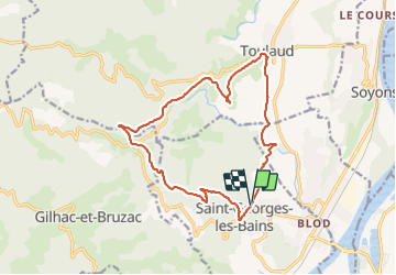
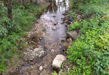
Ruta Senderismo de 16,4 km a descubrir en Auvergne-Rhône-Alpes, Ardecha, Saint-Georges-les-Bains. Esta ruta ha sido propuesta por Jean Claude Marchand.
Descripción
St Georges-les-Bains, Serre de Planèze et les sculpteurs sur pierre, Col du Rotisson, Serre Chalamant, Toulaud.
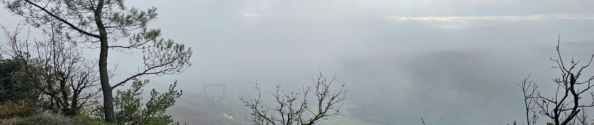
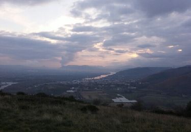
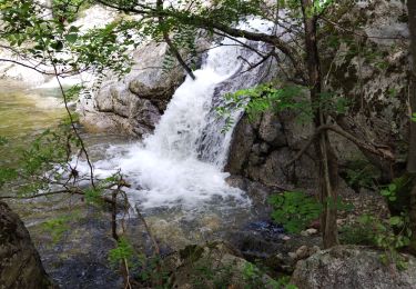
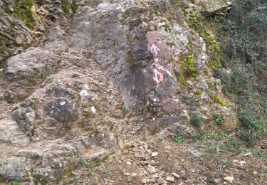
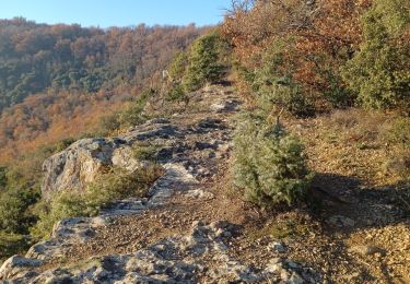
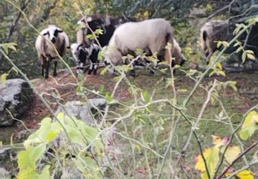
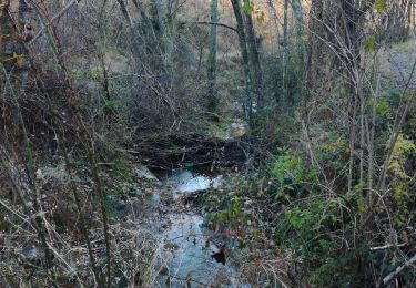
Localización
País:
France
Región :
Auvergne-Rhône-Alpes
Departamento/provincia :
Ardecha
Municipio :
Saint-Georges-les-Bains
Localidad:
Unknown
Salida:(Dec)
Salida:(UTM)
643148 ; 4969370 (31T) N.
Comentarios
Excursiones cerca
![Excursión Senderismo Beauchastel - Beauchastel. / Pierre Gourde - Photo](https://media.geolcdn.com/t/375/260/ext.jpg?maxdim=2&url=https%3A%2F%2Fservices.sitytrail.com%2FGeolivesWS%2FDownloadMedia.ashx%3FTrailID%3D500378%26Media%3Dfix__20151206162513.jpg)
![Senderismo Senderismo](https://static1.geolcdn.com/sitytour/trail-icons/101.png)
Beauchastel. / Pierre Gourde
Senderismo
Medio
(3)
Beauchastel,
Auvergne-Rhône-Alpes,
Ardecha,
France
![](/images/other/stat-length.png)
21 km | 30 km-effort
6h 40min
![](https://static1.geolcdn.com/siteimages/upload/files/16400158638029165_repeat_loop_refresh_sync_direction_icon.png)
Sí
![Excursión Senderismo Saint-Laurent-du-Pape - Pierre gourde TeD Christian - Photo](https://media.geolcdn.com/t/375/260/ext.jpg?maxdim=2&url=https%3A%2F%2Fstatic1.geolcdn.com%2Fsiteimages%2Fupload%2Ffiles%2F1553511878bg_sport_marche.png)
![Senderismo Senderismo](https://static1.geolcdn.com/sitytour/trail-icons/101.png)
Pierre gourde TeD Christian
Senderismo
Fácil
(1)
Saint-Laurent-du-Pape,
Auvergne-Rhône-Alpes,
Ardecha,
France
![](/images/other/stat-length.png)
8,6 km | 13,7 km-effort
3h 1min
![](https://static1.geolcdn.com/siteimages/upload/files/16400158638029165_repeat_loop_refresh_sync_direction_icon.png)
Sí
![Excursión Senderismo - boucle rotisson col de mure - Photo](https://media.geolcdn.com/t/375/260/ext.jpg?maxdim=2&url=https%3A%2F%2Fstatic1.geolcdn.com%2Fsiteimages%2Fupload%2Ffiles%2F1553511878bg_sport_marche.png)
![Senderismo Senderismo](https://static1.geolcdn.com/sitytour/trail-icons/101.png)
boucle rotisson col de mure
Senderismo
Medio
(1)
,
Auvergne-Rhône-Alpes,
Ardecha,
France
![](/images/other/stat-length.png)
16,4 km | 23 km-effort
4h 0min
![](https://static1.geolcdn.com/siteimages/upload/files/16400158638029165_repeat_loop_refresh_sync_direction_icon.png)
Sí
![Excursión Senderismo Toulaud - l'Embroye - Photo](https://media.geolcdn.com/t/375/260/ext.jpg?maxdim=2&url=https%3A%2F%2Fmedia.geolcdn.com%2Ff%2Fcb947bb6-7dc1-43ba-a067-9c4f7f015103.jpg)
![Senderismo Senderismo](https://static1.geolcdn.com/sitytour/trail-icons/101.png)
l'Embroye
Senderismo
Medio
Toulaud,
Auvergne-Rhône-Alpes,
Ardecha,
France
![](/images/other/stat-length.png)
12,6 km | 19,6 km-effort
6h 9min
![](https://static1.geolcdn.com/siteimages/upload/files/16400158638029165_repeat_loop_refresh_sync_direction_icon.png)
No
![Excursión Senderismo Toulaud - 07 toulaud - Photo](https://media.geolcdn.com/t/375/260/ext.jpg?maxdim=2&url=https%3A%2F%2Fmedia.geolcdn.com%2Ff%2F89acc3af-3d99-4629-8f1e-c7b281476088.jpg)
![Senderismo Senderismo](https://static1.geolcdn.com/sitytour/trail-icons/101.png)
07 toulaud
Senderismo
Muy fácil
Toulaud,
Auvergne-Rhône-Alpes,
Ardecha,
France
![](/images/other/stat-length.png)
7,1 km | 10,9 km-effort
2h 24min
![](https://static1.geolcdn.com/siteimages/upload/files/16400158638029165_repeat_loop_refresh_sync_direction_icon.png)
Sí
![Excursión Senderismo Saint-Georges-les-Bains - col de Rotison - Photo](https://media.geolcdn.com/t/375/260/ext.jpg?maxdim=2&url=https%3A%2F%2Fmedia.geolcdn.com%2Ff%2F8c3d1009-c72f-4ec6-bf61-7a2fde476dc2.jpg)
![Senderismo Senderismo](https://static1.geolcdn.com/sitytour/trail-icons/101.png)
col de Rotison
Senderismo
Difícil
Saint-Georges-les-Bains,
Auvergne-Rhône-Alpes,
Ardecha,
France
![](/images/other/stat-length.png)
9,4 km | 14,4 km-effort
6h 7min
![](https://static1.geolcdn.com/siteimages/upload/files/16400158638029165_repeat_loop_refresh_sync_direction_icon.png)
Sí
![Excursión Senderismo Toulaud - Gorges de l'Embroye - Photo](https://media.geolcdn.com/t/375/260/ext.jpg?maxdim=2&url=https%3A%2F%2Fmedia.geolcdn.com%2Ff%2F050f228b-bc3c-4cca-b6f5-b260ca37e31b.jpg)
![Senderismo Senderismo](https://static1.geolcdn.com/sitytour/trail-icons/101.png)
Gorges de l'Embroye
Senderismo
Difícil
Toulaud,
Auvergne-Rhône-Alpes,
Ardecha,
France
![](/images/other/stat-length.png)
7,3 km | 10,5 km-effort
2h 45min
![](https://static1.geolcdn.com/siteimages/upload/files/16400158638029165_repeat_loop_refresh_sync_direction_icon.png)
Sí
![Excursión Senderismo - Gilhac et Bruzac - Photo](https://media.geolcdn.com/t/375/260/ext.jpg?maxdim=2&url=https%3A%2F%2Fmedia.geolcdn.com%2Ff%2F551bf316-8a83-4ef1-91f0-f74ec142bac0.jpg)
![Senderismo Senderismo](https://static1.geolcdn.com/sitytour/trail-icons/101.png)
Gilhac et Bruzac
Senderismo
Medio
,
Auvergne-Rhône-Alpes,
Ardecha,
France
![](/images/other/stat-length.png)
17,9 km | 25 km-effort
8h 4min
![](https://static1.geolcdn.com/siteimages/upload/files/16400158638029165_repeat_loop_refresh_sync_direction_icon.png)
Sí
![Excursión Senderismo Saint-Laurent-du-Pape - 07 st Laurent du pape P Gourde 060521 - Photo](https://media.geolcdn.com/t/375/260/ext.jpg?maxdim=2&url=https%3A%2F%2Fmedia.geolcdn.com%2Ff%2Fab7e67df-3108-4810-a988-7cdece498721.jpg)
![Senderismo Senderismo](https://static1.geolcdn.com/sitytour/trail-icons/101.png)
07 st Laurent du pape P Gourde 060521
Senderismo
Fácil
(1)
Saint-Laurent-du-Pape,
Auvergne-Rhône-Alpes,
Ardecha,
France
![](/images/other/stat-length.png)
13,9 km | 22 km-effort
5h 56min
![](https://static1.geolcdn.com/siteimages/upload/files/16400158638029165_repeat_loop_refresh_sync_direction_icon.png)
Sí