Rieutort-de-Randon, Monts-de-Randon, A pied : Les meilleures randonnées, itinéraires, parcours, balades et promenades

7 commentaires

Rieutort-de-Randon : découvrez les meilleures randonnées : 1 a pied et 23 marche. Tous ces circuits, parcours, itinéraires et activités en plein air sont disponibles dans nos applications SityTrail pour smartphones et tablettes.


Les meilleurs parcours (24)

Randonnée Marche Monts-de-Randon - Rando du 13/05/2024..Rieutor de Randon..Truc de Fortuneo..Lac de Charpal - Photo
Marche 23.319
Km

Marche

Difficile
Monts-de-Randon, Occitanie, Lozère, France
23 km | 32 km-effort
5h 8min
629 m
621 m
Oui
boubou68

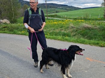
• Owen nous a accompagné toute la journée...

Randonnée Marche Monts-de-Randon - Le tour du lac de Charpal - Photo
Marche 9.005
Km

Marche

Très facile
(1)
Monts-de-Randon, Occitanie, Lozère, France
9 km | 10,2 km-effort
2h 20min
90 m
94 m
Oui
alainjoseph6

• géniale

Randonnée Marche Monts-de-Randon - tour du lamc Charpal - Photo
Marche 9.411
Km

Marche

Facile
(2)
Monts-de-Randon, Occitanie, Lozère, France
9,4 km | 10,8 km-effort
3h 5min
106 m
100 m
Oui
eerm

Randonnée Marche Monts-de-Randon - Charpal - Photo
Marche 17.636
Km

Marche

Facile
Monts-de-Randon, Occitanie, Lozère, France
17,6 km | 22 km-effort
5h 11min
304 m
313 m
Oui
tyntyn

Randonnée Marche Monts-de-Randon - 13/5/24 - Photo
Marche 23.977
Km

Marche

Très difficile
Monts-de-Randon, Occitanie, Lozère, France
24 km | 32 km-effort
5h 9min
637 m
636 m
Oui
Alain28/01

• Belle journée à travers, pissenlits, genets en fleurs et forêts d'épicéas. Notre compagnon du jour Owen nous a suivi ...

Randonnée Marche Monts-de-Randon - Truc de Fortunio et lac de Charpal - Photo
Marche 16.579
Km

Marche

Moyen
Monts-de-Randon, Occitanie, Lozère, France
16,6 km | 22 km-effort
5h 48min
380 m
386 m
Oui
jesusmarieclaire

Randonnée Marche Monts-de-Randon - Tour du lac de Charpal - Photo
Marche 9.135
Km

Marche

Moyen
Monts-de-Randon, Occitanie, Lozère, France
9,1 km | 10,5 km-effort
1h 59min
105 m
102 m
Oui
isa43

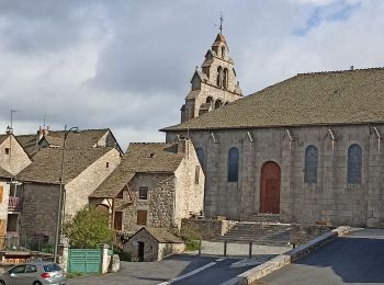
• Tour magnifique au petit matin

Randonnée Marche Monts-de-Randon - Mende (48) - Photo
Marche 8.835
Km

Marche

Très facile
Monts-de-Randon, Occitanie, Lozère, France
8,8 km | 10,2 km-effort
2h 19min
103 m
103 m
Oui
AndreLACOMBE

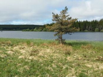
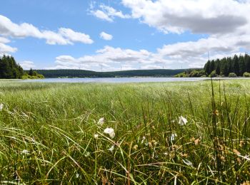
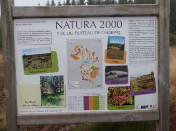
• Tour du lac de Charpal

Randonnée Marche Monts-de-Randon - Charpal - Photo
Marche 9.841
Km

Marche

Très facile
Monts-de-Randon, Occitanie, Lozère, France
9,8 km | 11,3 km-effort
3h 0min
108 m
113 m
Oui
fga33

Randonnée Marche Monts-de-Randon - Truc de fortunio charmâmes - Photo
Marche 19.426
Km

Marche

Facile
Monts-de-Randon, Occitanie, Lozère, France
19,4 km | 24 km-effort
6h 6min
376 m
376 m
Oui
anne-marie Gineste

Randonnée Marche Monts-de-Randon - Lac de  Charpal - Photo
Marche 9.043
Km

Marche

Très facile
Monts-de-Randon, Occitanie, Lozère, France
9 km | 10,3 km-effort
2h 19min
92 m
92 m
Oui
OUSSET

Randonnée A pied Monts-de-Randon - 11bis-Fortunio et Charpal - Photo
A pied 16.982
Km

A pied

Moyen
Monts-de-Randon, Occitanie, Lozère, France
17 km | 24 km-effort
5h 28min
535 m
532 m
Oui
Blogus

Randonnée Marche Monts-de-Randon - Rieutord/Vitrolles/Coulanges Basses - Photo
Marche 5.252
Km

Marche

Facile
Monts-de-Randon, Occitanie, Lozère, France
5,3 km | 7,5 km-effort
58min
166 m
167 m
Oui
tyntyn

Randonnée Marche Monts-de-Randon - randon - Photo
Marche 12.182
Km

Marche

Facile
Monts-de-Randon, Occitanie, Lozère, France
12,2 km | 16,4 km-effort
3h 24min
317 m
318 m
Oui
tyntyn

Randonnée Marche Monts-de-Randon - charpal1 - Photo
Marche 31.842
Km

Marche

Très difficile
Monts-de-Randon, Occitanie, Lozère, France
32 km | 44 km-effort
16h 45min
844 m
1051 m
Non
fario

Randonnée Marche Monts-de-Randon - Lac De Charpal
Marche 4.77
Km

Marche

Facile
Monts-de-Randon, Occitanie, Lozère, France
4,8 km | 6 km-effort
1h 21min
92 m
92 m
Oui
Strabidja

Randonnée Marche Monts-de-Randon - charpal la chapelle vitrolette,fortunio - Photo
Marche 13.244
Km

Marche

Moyen
Monts-de-Randon, Occitanie, Lozère, France
13,2 km | 18,3 km-effort
4h 9min
379 m
378 m
Oui
tyntyn

Randonnée Marche Monts-de-Randon - charpal vitrolette fortunio  - Photo
Marche 15.116
Km

Marche

Très difficile
Monts-de-Randon, Occitanie, Lozère, France
15,1 km | 21 km-effort
4h 40min
410 m
415 m
Oui
tyntyn

Randonnée Marche Monts-de-Randon - truc de fortunio - Photo
Marche 12.132
Km

Marche

Facile
Monts-de-Randon, Occitanie, Lozère, France
12,1 km | 17,6 km-effort
3h 25min
408 m
406 m
Oui
moufouette

Randonnée Marche Monts-de-Randon - lac de charpal  fage laubert - Photo
Marche 26.959
Km

Marche

Très difficile
Monts-de-Randon, Occitanie, Lozère, France
27 km | 34 km-effort
7h 44min
534 m
527 m
Oui
boyer43

20 randonnées affichées sur 24

Application GPS de randonnée GRATUITE

Logo SityTrail SityTrail

IGN / Instituts géographiques

Télécharger SityTrail sur l'App Store Télécharger SityTrail sur Google Play

Logo SityTrail SityTrail World

Le monde est à vous

Télécharger SityTrail sur l'App Store Télécharger SityTrail sur Google Play Télécharger SityTrail sur Huawei AppGallery

Activités

Fermer
Mes abonnements