![](/images/other/stat-length.png)
Celles, Dordogne, A pied : Les meilleures randonnées, itinéraires, parcours, balades et promenades
Celles : découvrez les meilleures randonnées : 3 marche. Tous ces circuits, parcours, itinéraires et activités en plein air sont disponibles dans nos applications SityTrail pour smartphones et tablettes.
Les meilleurs parcours (3)
![Randonnée Marche Celles - Boucle de Celles - Photo](https://media.geolcdn.com/t/350/260/ext.jpg?maxdim=2&url=https%3A%2F%2Fmedia.geolcdn.com%2Ff%2F42dfacb0-24d9-4201-94af-6756333c6246.jpg)
![Marche Marche](https://static1.geolcdn.com/sitytour/trail-icons/101.png)
Km
#1 - Boucle de Celles
Marche
Facile
Celles,
Nouvelle-Aquitaine,
Dordogne,
France
![](/images/other/stat-length.png)
12,8 km | 16,4 km-effort
3h 10min
![](https://static1.geolcdn.com/siteimages/upload/files/1508320355ic_sort_den_pos_24dp.png)
270 m
![](https://static1.geolcdn.com/siteimages/upload/files/1508320355ic_sort_den_neg_24dp.png)
271 m
![](https://static1.geolcdn.com/siteimages/upload/files/16400158638029165_repeat_loop_refresh_sync_direction_icon.png)
Oui
swp648
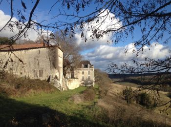
• Belles vues sur les cultures et randonnée très vallonnée.
![Randonnée Marche Celles - boucle celles - Photo](https://media.geolcdn.com/t/350/260/ext.jpg?maxdim=2&url=https%3A%2F%2Fmedia.geolcdn.com%2Ff%2F800fe37f-eb51-4b84-a21b-f7c13895188c.jpg)
![Marche Marche](https://static1.geolcdn.com/sitytour/trail-icons/101.png)
Km
#2 - boucle celles
Marche
Facile
Celles,
Nouvelle-Aquitaine,
Dordogne,
France
![](/images/other/stat-length.png)
13 km | 16,7 km-effort
3h 6min
![](https://static1.geolcdn.com/siteimages/upload/files/1508320355ic_sort_den_pos_24dp.png)
274 m
![](https://static1.geolcdn.com/siteimages/upload/files/1508320355ic_sort_den_neg_24dp.png)
273 m
![](https://static1.geolcdn.com/siteimages/upload/files/16400158638029165_repeat_loop_refresh_sync_direction_icon.png)
Oui
fab0202
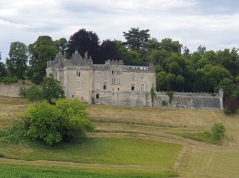
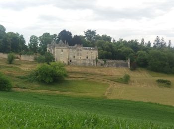
• belle rando avec vue sur le chateau de montardy.
![Randonnée Marche Celles - 24 Celles - Photo](https://media.geolcdn.com/t/350/260/ext.jpg?maxdim=2&url=https%3A%2F%2Fservices.sitytrail.com%2FGeolivesWS%2FDownloadMedia.ashx%3FTrailID%3D684752%26Media%3D20170114154521.jpg)
![Marche Marche](https://static1.geolcdn.com/sitytour/trail-icons/101.png)
Km
#3 - 24 Celles
Marche
Facile
Celles,
Nouvelle-Aquitaine,
Dordogne,
France
![](/images/other/stat-length.png)
13,2 km | 16,8 km-effort
3h 34min
![](https://static1.geolcdn.com/siteimages/upload/files/1508320355ic_sort_den_pos_24dp.png)
268 m
![](https://static1.geolcdn.com/siteimages/upload/files/1508320355ic_sort_den_neg_24dp.png)
271 m
![](https://static1.geolcdn.com/siteimages/upload/files/16400158638029165_repeat_loop_refresh_sync_direction_icon.png)
Oui
Patxito
3 randonnées affichées sur 3
Application GPS de randonnée GRATUITE