


13,2 km | 16,5 km-effort
Basse-Pointe : découvrez les meilleures randonnées : 2 a pied, 42 marche et 1 course à pied. Tous ces circuits, parcours, itinéraires et activités en plein air sont disponibles dans nos applications SityTrail pour smartphones et tablettes.
Marche


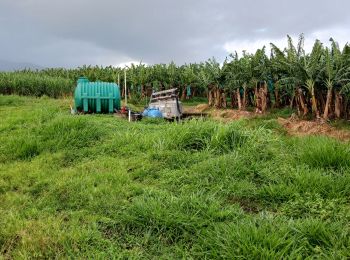
• - Cette randonnée sur exploitations agricoles de Basse-Pointe, au Nord, nécessite obligatoirement des aut...
Marche
• Randonnée de famille, en quittant le parking de Chalvet vers le site de fév. 74 ! faire une petite jonction vers l'em...
Marche
• Grande randonnée dans les plantations et habitations de Basse pointe. Habituer de la randonnée et l'histoire des Hbt ...
Marche
• Vérifications, nettoyage et rafraîchissement des balises GR sur cette portion du littoral. Circuit dans l'ensemble ...
Marche
• Demandes d'autorisations de passages obligatoires pour la traversée des Habitations.
Marche
• Cette randonnée nécessite deux autorisations de passages pour les habitations Gradis et Hackaert. Surtout, éviter ...
Marche
Marche
• randonnée
A pied
• Sentier Littoral Nord-Atlantique, (SLNA) projet de tracé Ce projet de tracé qui évite le plus possible d’emprunter l...
A pied
• Sentier Littoral Nord-Atlantique, (SLNA) projet de tracé Ce projet de tracé qui évite le plus possible d’emprunter l...
Marche
Marche
• randonnée Pedestre CO Entraînement
Marche
Marche
Marche
Marche
Marche

Marche
• Petite randonnée qui consiste à se rendre à la prise d'eau sur la rivière Falaise. Bananeraies, Paysages sur le sect...
Marche
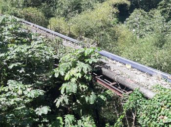
• Etude de la faisabilité du passage du SLNA. Passerelle inutilisable quant à présent. Sentier non utilisable pour le...
Marche
• - Cette randonnée sur exploitations agricoles de Basse-Pointe, au Nord, nécessite obligatoirement des aut...
20 randonnées affichées sur 44
Application GPS de randonnée GRATUITE
 SityTrail
IGN / Instituts géographiques
SityTrail World
Le monde est à vous