Randonnée V.T.T. Arthenac - Arthenac 2010 - Photo
 tracegps
tracegps

Utilisateur

© OpenStreetMap contributors
Longueur
Longueur
30 km
Altitude max
Altitude max
123 m
Dénivelé positif
Dénivelé positif
397 m
Km-Effort
Km-Effort  
35 km
Altitude min
Altitude min
53 m
Dénivelé négatif
Dénivelé négatif
397 m
Boucle
Boucle
Oui
Date de création :
2014-12-10 00:00:00.0
Dernière modification :
2014-12-10 00:00:00.0

(0 Avis)

V.T.T.
V.T.T.
2h19
Difficulté : Moyen

Scannez ce code QR pour ouvrir la randonnée dans l'application SityTrail

Application GPS de randonnée GRATUITE

Logo SityTrail SityTrail

IGN / Instituts géographiques

Télécharger SityTrail sur l'App Store Télécharger SityTrail sur Google Play

Logo SityTrail SityTrail World

Le monde est à vous

Télécharger SityTrail sur l'App Store Télécharger SityTrail sur Google Play Télécharger SityTrail sur Huawei AppGallery

À propos

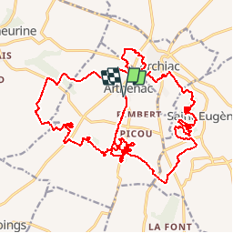
Randonnée V.T.T. de 30 km à découvrir à Nouvelle-Aquitaine, Charente-Maritime, Arthenac. Cette randonnée est proposée par tracegps.

Description

Circuit très sympa en sous-bois très vallonné. Michel

Profil altimétrique

Localisation

Pays :
France
Région :
Nouvelle-Aquitaine
Département/Province :
Charente-Maritime
Commune :
Arthenac
Localité :
Unknown
Départ:(Dec)
Départ:(UTM)
709710 ; 5043483 (30T) N.

Randonnées à proximité

Randonnée Marche Réaux-sur-Trèfle - Le Trèfle entre Viveronne et Tâtre - Photo
Marche
neoroll44

Marche

Moyen
Réaux-sur-Trèfle, Nouvelle-Aquitaine, Charente-Maritime, France
9,5 km | 10,4 km-effort
2h 20min
Oui
Randonnée A pied Allas-Champagne - Téléthon 2019 - Photo
A pied
JACQUOU

A pied

Très facile
Allas-Champagne, Nouvelle-Aquitaine, Charente-Maritime, France
10,5 km | 11,5 km-effort
2min
Oui
Randonnée Marche Réaux-sur-Trèfle - moings - Photo
Marche
nicole.reine@wanadoo.fr

Marche

Très facile
Réaux-sur-Trèfle, Nouvelle-Aquitaine, Charente-Maritime, France
10,6 km | 11,6 km-effort
2h 33min
Oui
Randonnée V.T.T. Arthenac - Tour du bois des fées - Photo
V.T.T.
Noiraude

V.T.T.

Moyen
Arthenac, Nouvelle-Aquitaine, Charente-Maritime, France
8,5 km | 9,8 km-effort
1h 29min
Oui
Randonnée Marche Sainte-Lheurine - st Lheurine - Photo
Marche
JACQUOU

Marche

Moyen
Sainte-Lheurine, Nouvelle-Aquitaine, Charente-Maritime, France
12,7 km | 14,5 km-effort
3h 12min
Oui
Randonnée Marche Allas-Champagne - Allas Champagne 15 - Photo
Marche
nijo17

Marche

Difficile
Allas-Champagne, Nouvelle-Aquitaine, Charente-Maritime, France
15 km | 16,9 km-effort
2h 58min
Oui
Randonnée Marche Réaux-sur-Trèfle - Moings 10,5km  - Photo
Marche
JACQUOU

Marche

Facile
Réaux-sur-Trèfle, Nouvelle-Aquitaine, Charente-Maritime, France
10,6 km | 11,6 km-effort
2h 21min
Oui
Randonnée Marche Réaux-sur-Trèfle - Réaux sur Tréfle 10km - Photo
Marche
JACQUOU

Marche

Facile
Réaux-sur-Trèfle, Nouvelle-Aquitaine, Charente-Maritime, France
9,7 km | 11,1 km-effort
2h 31min
Oui
Randonnée V.T.T. Arthenac - Rando moulin germain on - Photo
V.T.T.
Mathilde Gourdet

V.T.T.

Moyen
Arthenac, Nouvelle-Aquitaine, Charente-Maritime, France
8,1 km | 9,5 km-effort
2h 54min
Oui


Fermer
Mes abonnements