![](/images/other/stat-length.png)
![Randonnée Cheval Brassac - Ganac - Col du Calmil - Photo](https://media.geolcdn.com/t/1900/400/ext.pjpeg?maxdim=2&url=https%3A%2F%2Fservices.sitytrail.com%2FGeolivesWS%2FDownloadMedia.ashx%3FTrailID%3D108259%26Media%3D901_1.jpg)
Ganac - Col du Calmil
tracegps
Utilisateur
![Longueur](/images/other/stat-length.png)
Longueur
4,1 km
![Altitude max](https://static1.geolcdn.com/siteimages/upload/files/1508320355ic_sort_altitude_max_24dp.png)
Altitude max
1104 m
![Dénivelé positif](https://static1.geolcdn.com/siteimages/upload/files/1508320355ic_sort_den_pos_24dp.png)
Dénivelé positif
0 m
![Km-Effort](/images/other/stat-length.png)
Km-Effort
6 km
![Altitude min](https://static1.geolcdn.com/siteimages/upload/files/1508320355ic_sort_altitude_min_24dp.png)
Altitude min
520 m
![Dénivelé négatif](https://static1.geolcdn.com/siteimages/upload/files/1508320355ic_sort_den_neg_24dp.png)
Dénivelé négatif
577 m
![Boucle](https://static1.geolcdn.com/siteimages/upload/files/16400158638029165_repeat_loop_refresh_sync_direction_icon.png)
Boucle
Non
Date de création :
2014-12-10 00:00:00.0
Dernière modification :
2014-12-10 00:00:00.0
![Cheval](https://static1.geolcdn.com/sitytour/trail-icons/300.png)
30m
Difficulté : Moyen
![Scannez ce code QR pour ouvrir la randonnée dans l'application SityTrail](https://capi.geolives.com/qq0zvz2zws4bq2lad0pu/sitytour/trails/108259/qr.png?size=200)
Application GPS de randonnée GRATUITE
À propos
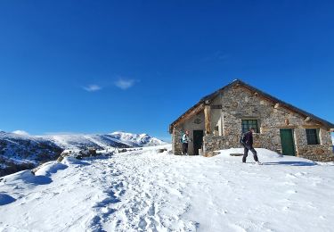
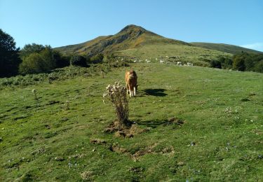
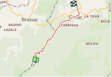
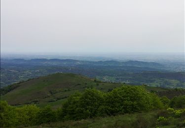
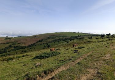
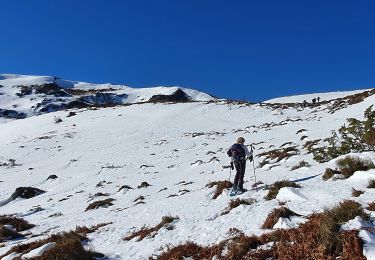
Randonnée Cheval de 4,1 km à découvrir à Occitanie, Ariège, Brassac. Cette randonnée est proposée par tracegps.
Description
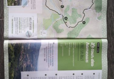
Balade proposée par le Bureau des Guides Équestres Transpyrénéens Toutes les randonnées équestres dans les Pyrénées Sans Frontières à Cheval
Localisation
Pays :
France
Région :
Occitanie
Département/Province :
Ariège
Commune :
Brassac
Localité :
Unknown
Départ:(Dec)
Départ:(UTM)
380693 ; 4753714 (31T) N.
Commentaires
Randonnées à proximité
![Randonnée V.T.T. Ganac - Prat Albis - Verniolle - Photo](https://media.geolcdn.com/t/375/260/ext.jpg?maxdim=2&url=https%3A%2F%2Fservices.sitytrail.com%2FGeolivesWS%2FDownloadMedia.ashx%3FTrailID%3D128789%26Media%3D05b2f854-454a-4b38-ac8f-0c42da59f54b.jpg)
![V.T.T. V.T.T.](https://static1.geolcdn.com/sitytour/trail-icons/202.png)
Prat Albis - Verniolle
V.T.T.
Difficile
(1)
Ganac,
Occitanie,
Ariège,
France
![](/images/other/stat-length.png)
30 km | 36 km-effort
2h 30min
![](https://static1.geolcdn.com/siteimages/upload/files/16400158638029165_repeat_loop_refresh_sync_direction_icon.png)
Non
![Randonnée Marche Ganac - Prat d'Albis - Photo](https://media.geolcdn.com/t/375/260/ext.jpg?maxdim=2&url=https%3A%2F%2Fmedia.geolcdn.com%2Ff%2F94538044-696f-49c3-99b2-381f51b7e113.jpg)
![Marche Marche](https://static1.geolcdn.com/sitytour/trail-icons/101.png)
Prat d'Albis
Marche
Très facile
Ganac,
Occitanie,
Ariège,
France
![](/images/other/stat-length.png)
8,6 km | 12,6 km-effort
3h 2min
![](https://static1.geolcdn.com/siteimages/upload/files/16400158638029165_repeat_loop_refresh_sync_direction_icon.png)
Non
![Randonnée A pied Brassac - Le Picou depuis Brassac - Photo](https://media.geolcdn.com/t/375/260/ext.jpg?maxdim=2&url=https%3A%2F%2Fmedia.geolcdn.com%2Ff%2F22e65925-2aed-45df-a24b-d9dbd1aee596.jpeg)
![A pied A pied](https://static1.geolcdn.com/sitytour/trail-icons/100.png)
Le Picou depuis Brassac
A pied
Facile
Brassac,
Occitanie,
Ariège,
France
![](/images/other/stat-length.png)
5 km | 14,7 km-effort
3h 20min
![](https://static1.geolcdn.com/siteimages/upload/files/16400158638029165_repeat_loop_refresh_sync_direction_icon.png)
Non
![Randonnée Marche Saurat - balade sauratoise - Photo](https://media.geolcdn.com/t/375/260/ext.jpg?maxdim=2&url=https%3A%2F%2Fservices.sitytrail.com%2FGeolivesWS%2FDownloadMedia.ashx%3FTrailID%3D563459%26Media%3Dfix__20160504091755.jpg)
![Marche Marche](https://static1.geolcdn.com/sitytour/trail-icons/101.png)
balade sauratoise
Marche
Moyen
Saurat,
Occitanie,
Ariège,
France
![](/images/other/stat-length.png)
11,3 km | 19,4 km-effort
3h 46min
![](https://static1.geolcdn.com/siteimages/upload/files/16400158638029165_repeat_loop_refresh_sync_direction_icon.png)
Oui
![Randonnée V.T.T. Ganac - prat - prayols 1 - Photo](https://media.geolcdn.com/t/375/260/ext.jpg?maxdim=2&url=https%3A%2F%2Fstatic1.geolcdn.com%2Fsiteimages%2Fupload%2Ffiles%2F1524743154velo.jpg)
![V.T.T. V.T.T.](https://static1.geolcdn.com/sitytour/trail-icons/202.png)
prat - prayols 1
V.T.T.
Moyen
(1)
Ganac,
Occitanie,
Ariège,
France
![](/images/other/stat-length.png)
7,7 km | 11,1 km-effort
41min
![](https://static1.geolcdn.com/siteimages/upload/files/16400158638029165_repeat_loop_refresh_sync_direction_icon.png)
Non
![Randonnée Marche Saurat - Cap de l'Escalot (tentative), en boucle - Photo](https://media.geolcdn.com/t/375/260/ext.jpg?maxdim=2&url=https%3A%2F%2Fmedia.geolcdn.com%2Ff%2Fbd19372a-944d-48c8-9649-c1eb814b2542.jpg)
![Marche Marche](https://static1.geolcdn.com/sitytour/trail-icons/101.png)
Cap de l'Escalot (tentative), en boucle
Marche
Moyen
Saurat,
Occitanie,
Ariège,
France
![](/images/other/stat-length.png)
11,3 km | 22 km-effort
7h 29min
![](https://static1.geolcdn.com/siteimages/upload/files/16400158638029165_repeat_loop_refresh_sync_direction_icon.png)
Oui
![Randonnée Marche Serres-sur-Arget - SERRES Sur ARGET - Photo](https://media.geolcdn.com/t/375/260/ext.jpg?maxdim=2&url=https%3A%2F%2Fmedia.geolcdn.com%2Ff%2Fa178165b-4020-47c1-b1aa-022ac0a6feb3.jpg)
![Marche Marche](https://static1.geolcdn.com/sitytour/trail-icons/101.png)
SERRES Sur ARGET
Marche
Moyen
Serres-sur-Arget,
Occitanie,
Ariège,
France
![](/images/other/stat-length.png)
10,6 km | 14,5 km-effort
2h 48min
![](https://static1.geolcdn.com/siteimages/upload/files/16400158638029165_repeat_loop_refresh_sync_direction_icon.png)
Oui
![Randonnée Marche Ganac - cabane des Bladas - Photo](https://media.geolcdn.com/t/375/260/ext.jpg?maxdim=2&url=https%3A%2F%2Fmedia.geolcdn.com%2Ff%2F8bd150a0-3aab-453f-8910-10bb01e9a7c9.jpg)
![Marche Marche](https://static1.geolcdn.com/sitytour/trail-icons/101.png)
![Randonnée Marche Prayols - picou - Photo](https://media.geolcdn.com/t/375/260/ext.jpg?maxdim=2&url=https%3A%2F%2Fmedia.geolcdn.com%2Ff%2Fd03a81ba-1538-441a-8827-4fe23687f060.jpg)
![Marche Marche](https://static1.geolcdn.com/sitytour/trail-icons/101.png)