


plainfaing => lac blanc pour descente VTT

Chiroptere
Utilisateur
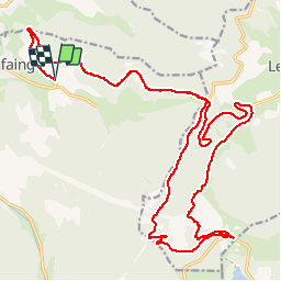

Longueur
30 km

Altitude max
1157 m

Dénivelé positif
836 m
Km-Effort
41 km

Altitude min
593 m

Dénivelé négatif
834 m
Boucle
Oui
Date de création :
2014-12-10 00:00:00.0
Dernière modification :
2014-12-10 00:00:00.0
2h30
Difficulté : Facile

Application GPS de randonnée GRATUITE
 SityTrail
IGN / Instituts géographiques
SityTrail Plus
Le monde est à vous
À propos
Randonnée V.T.T. de 30 km à découvrir à Grand Est, Vosges, Plainfaing. Cette randonnée est proposée par Chiroptere.
Localisation
Pays :
France
Région :
Grand Est
Département/Province :
Vosges
Commune :
Plainfaing
Localité :
Unknown
Départ:(Dec)
Départ:(UTM)
353660 ; 5337006 (32U) N.
Commentaires