Randonnée Marche Belfort - Rando-les hauts de belfort - Photo
 benoit747
benoit747

Utilisateur

© OpenStreetMap contributors
Longueur
Longueur
9,4 km
Altitude max
Altitude max
450 m
Dénivelé positif
Dénivelé positif
169 m
Km-Effort
Km-Effort  
11,6 km
Altitude min
Altitude min
358 m
Dénivelé négatif
Dénivelé négatif
167 m
Boucle
Boucle
Oui
Date de création :
2014-12-10 00:00:00.0
Dernière modification :
2018-12-03 10:08:54.079

(0 Avis)

Marche
Marche
2h00
Difficulté : Facile

Scannez ce code QR pour ouvrir la randonnée dans l'application SityTrail

Application GPS de randonnée GRATUITE

Logo SityTrail SityTrail

IGN / Instituts géographiques

Télécharger SityTrail sur l'App Store Télécharger SityTrail sur Google Play

Logo SityTrail SityTrail World

Le monde est à vous

Télécharger SityTrail sur l'App Store Télécharger SityTrail sur Google Play Télécharger SityTrail sur Huawei AppGallery

À propos

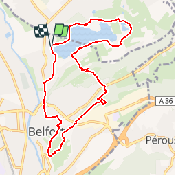
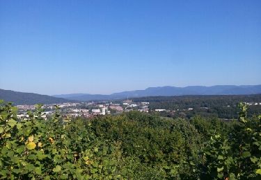
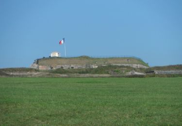
Randonnée Marche de 9,4 km à découvrir à Bourgogne-Franche-Comté, Territoire-de-Belfort, Belfort. Cette randonnée est proposée par benoit747.

Description

rando balisée rond vert, rectangle jaune.
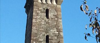
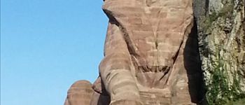
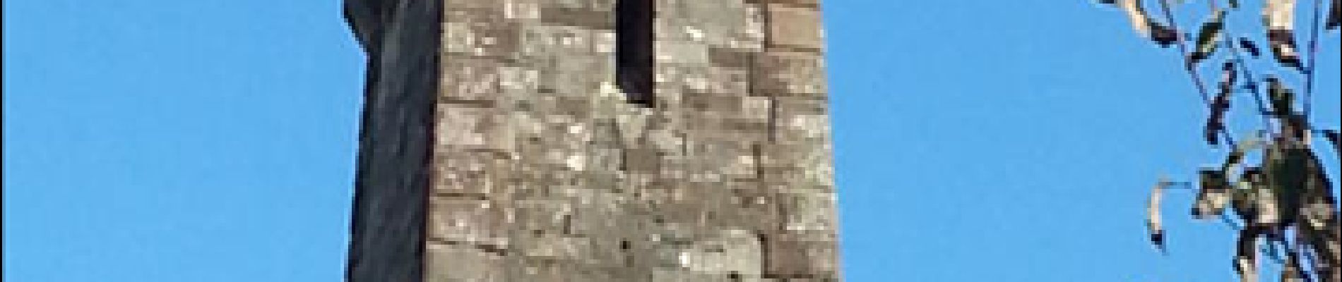
Une ballade sympa sur une demi journée qui vous permettra de découvrir les fortifications de Belfort

Profil altimétrique

Photos

Points d'intérêt

Point d'intérêt Belfort - la tour de la miotte - Photo
benoit747
Point d'intérêt Belfort - le lion de belfort - Photo
benoit747

Localisation

Pays :
France
Région :
Bourgogne-Franche-Comté
Département/Province :
Territoire-de-Belfort
Commune :
Belfort
Localité :
Unknown
Départ:(Dec)
Départ:(UTM)
339628 ; 5279886 (32T) N.

Randonnées à proximité

Randonnée Marche Belfort - Offemont - La ballade des Champs Cerisiers - Photo
Marche
bmorel@orange.fr

Marche

Facile
(1)
Belfort, Bourgogne-Franche-Comté, Territoire-de-Belfort, France
8,8 km | 10,8 km-effort
Inconnu
Oui
Randonnée Marche Sermamagny - Veronne PC - Photo
Marche
Papamoju

Marche

Très facile
(2)
Sermamagny, Bourgogne-Franche-Comté, Territoire-de-Belfort, France
8,1 km | 9 km-effort
1h 59min
Oui
Randonnée A pied Offemont - Sentier de la Roselière - Photo
A pied
PRO

A pied

Facile
Offemont, Bourgogne-Franche-Comté, Territoire-de-Belfort, France
3,9 km | 4,3 km-effort
58min
Oui
Randonnée V.T.T. Vézelois - 1er tour avec Olivier - Photo
V.T.T.
jibus90

V.T.T.

Facile
(1)
Vézelois, Bourgogne-Franche-Comté, Territoire-de-Belfort, France
38 km | 47 km-effort
2h 59min
Oui
Randonnée Marche Essert - Essert - Petit Salbert - Photo
Marche
Papamoju

Marche

Très facile
(1)
Essert, Bourgogne-Franche-Comté, Territoire-de-Belfort, France
7,4 km | 10,2 km-effort
2h 10min
Oui
Randonnée V.T.T. Belfort - tour de la miotte Blingarno  - Photo
V.T.T.
arno90000

V.T.T.

Moyen
Belfort, Bourgogne-Franche-Comté, Territoire-de-Belfort, France
10,5 km | 12,4 km-effort
52min
Oui
Randonnée V.T.T. Belfort - Transterritoire de Belfort 2011 - Photo
V.T.T.
tracegps

V.T.T.

Difficile
Belfort, Bourgogne-Franche-Comté, Territoire-de-Belfort, France
71 km | 91 km-effort
5h 0min
Oui
Randonnée Marche Belfort - Marche JO Belfort Couthenans - Photo
Marche
ISATR

Marche

Difficile
Belfort, Bourgogne-Franche-Comté, Territoire-de-Belfort, France
19,1 km | 23 km-effort
5h 19min
Non
Randonnée Marche Sermamagny - Le Malsaucy - Photo
Marche
ISATR

Marche

Très facile
Sermamagny, Bourgogne-Franche-Comté, Territoire-de-Belfort, France
9,7 km | 11,2 km-effort
2h 10min
Oui


Fermer
Mes abonnements