Randonnée Marche Théminettes - Theminettes dolmen - Photo

Theminettes dolmen

 gannet1
gannet1

Utilisateur

© OpenStreetMap contributors
Longueur
Longueur
9,8 km
Altitude max
Altitude max
360 m
Dénivelé positif
Dénivelé positif
121 m
Km-Effort
Km-Effort  
11,4 km
Altitude min
Altitude min
331 m
Dénivelé négatif
Dénivelé négatif
121 m
Boucle
Boucle
Oui
Date de création :
2014-12-10 00:00:00.0
Dernière modification :
2014-12-10 00:00:00.0

(0 Avis)

Marche
Marche
2h29
Difficulté : Très facile

Scannez ce code QR pour ouvrir la randonnée dans l'application SityTrail

Application GPS de randonnée GRATUITE

Logo SityTrail SityTrail

IGN / Instituts géographiques

Télécharger SityTrail sur l'App Store Télécharger SityTrail sur Google Play

Logo SityTrail SityTrail World

Le monde est à vous

Télécharger SityTrail sur l'App Store Télécharger SityTrail sur Google Play Télécharger SityTrail sur Huawei AppGallery

À propos

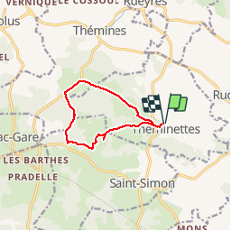
Randonnée Marche de 9,8 km à découvrir à Occitanie, Lot, Théminettes. Cette randonnée est proposée par gannet1.

Description

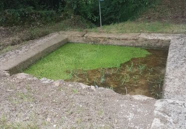
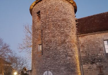
Passage près d''un dolmen un peu hors parcours. Causse et campagne plus verdoyante.
Testé par le groupe de marche SELM

Profil altimétrique

Photos

Points d'intérêt

Point d'intérêt Saint-Simon - dolmen - Photo
gannet1
SAINT-SIMON 

Localisation

Pays :
France
Région :
Occitanie
Département/Province :
Lot
Commune :
Théminettes
Localité :
Unknown
Départ:(Dec)
Départ:(UTM)
409227 ; 4951909 (31T) N.

Randonnées à proximité

Randonnée Marche Sonac - Theminettes Les Causses - Photo
Marche
gannet1

Marche

Facile
(4)
Sonac, Occitanie, Lot, France
14,6 km | 17,3 km-effort
3h 46min
Non
Randonnée Marche Théminettes - Theminette  - Photo
Marche
Gegetop

Marche

Facile
Théminettes, Occitanie, Lot, France
10,7 km | 12,4 km-effort
2h 36min
Oui
Randonnée Marche Thémines - Themines Rueyres 11km - Photo
Marche
houbart

Marche

Difficile
Thémines, Occitanie, Lot, France
10,8 km | 14 km-effort
3h 10min
Oui
Randonnée Marche Thémines - themine - Photo
Marche
thomas.o.vert

Marche

Facile
Thémines, Occitanie, Lot, France
10,6 km | 13,2 km-effort
2h 47min
Oui
Randonnée Marche Rudelle - rudelle - Photo
Marche
thomas.o.vert

Marche

Facile
Rudelle, Occitanie, Lot, France
9,3 km | 11,6 km-effort
2h 17min
Oui
Randonnée Marche Théminettes - theminettes - Photo
Marche
thomas.o.vert

Marche

Facile
Théminettes, Occitanie, Lot, France
11,9 km | 13,9 km-effort
2h 47min
Oui
Randonnée Marche Rueyres - rueyes  rudelle - Photo
Marche
gcournac

Marche

Difficile
Rueyres, Occitanie, Lot, France
14,4 km | 18,1 km-effort
3h 32min
Non
Randonnée Marche Assier - assier rs  - Photo
Marche
gcournac

Marche

Facile
Assier, Occitanie, Lot, France
5 km | 5,8 km-effort
1h 30min
Non
Randonnée V.T.T. Saint-Simon - reilhac gramat  - Photo
V.T.T.
lafé

V.T.T.

Facile
Saint-Simon, Occitanie, Lot, France
51 km | 58 km-effort
3h 53min
Oui


Fermer
Mes abonnements