![](/images/other/stat-length.png)
![Randonnée V.T.T. Angos - Angos - Sarouilles - Lac de l'Arrêt Darré - Photo](https://media.geolcdn.com/t/1900/400/ext.pjpeg?maxdim=2&url=https%3A%2F%2Fservices.sitytrail.com%2FGeolivesWS%2FDownloadMedia.ashx%3FTrailID%3D173031%26Media%3D14543_2.jpg)
Angos - Sarouilles - Lac de l'Arrêt Darré
tracegps
Utilisateur
![Longueur](/images/other/stat-length.png)
Longueur
26 km
![Altitude max](https://static1.geolcdn.com/siteimages/upload/files/1508320355ic_sort_altitude_max_24dp.png)
Altitude max
434 m
![Dénivelé positif](https://static1.geolcdn.com/siteimages/upload/files/1508320355ic_sort_den_pos_24dp.png)
Dénivelé positif
573 m
![Km-Effort](/images/other/stat-length.png)
Km-Effort
34 km
![Altitude min](https://static1.geolcdn.com/siteimages/upload/files/1508320355ic_sort_altitude_min_24dp.png)
Altitude min
244 m
![Dénivelé négatif](https://static1.geolcdn.com/siteimages/upload/files/1508320355ic_sort_den_neg_24dp.png)
Dénivelé négatif
575 m
![Boucle](https://static1.geolcdn.com/siteimages/upload/files/16400158638029165_repeat_loop_refresh_sync_direction_icon.png)
Boucle
Oui
Date de création :
2014-12-10 00:00:00.0
Dernière modification :
2014-12-10 00:00:00.0
![V.T.T.](https://static1.geolcdn.com/sitytour/trail-icons/202.png)
1h49
Difficulté : Difficile
![Scannez ce code QR pour ouvrir la randonnée dans l'application SityTrail](https://capi.geolives.com/qq0zvz2zws4bq2lad0pu/sitytour/trails/173031/qr.png?size=200)
Application GPS de randonnée GRATUITE
À propos
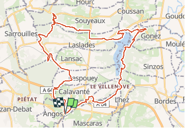
Randonnée V.T.T. de 26 km à découvrir à Occitanie, Hautes-Pyrénées, Angos. Cette randonnée est proposée par tracegps.
Description
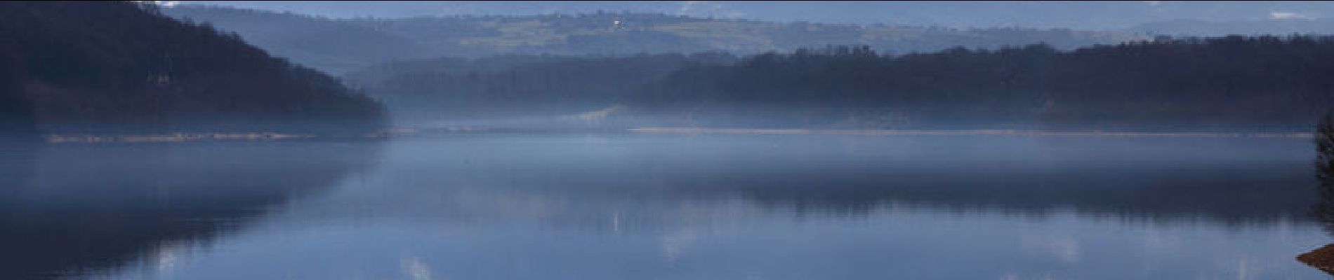
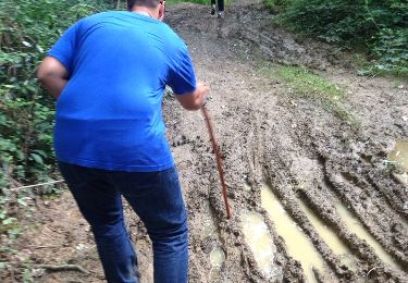
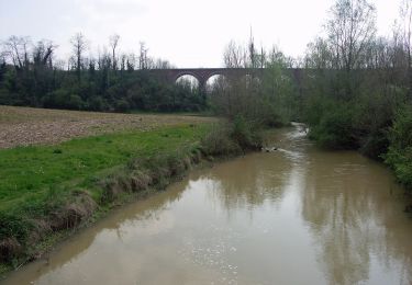
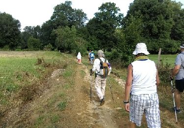
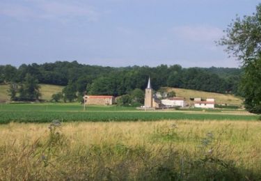
Circuit varié avec une vue imprenable sur les Pyrénées depuis le Lac du l'Arrêt Darré. Il est d'une difficulté que je qualifierai de Moyenne , la difficulté étant fonction du niveau de forme de chacun. Mon Etrex affichait 541m de dénivelé. Bonne balade.
Localisation
Pays :
France
Région :
Occitanie
Département/Province :
Hautes-Pyrénées
Commune :
Angos
Localité :
Unknown
Départ:(Dec)
Départ:(UTM)
268998 ; 4786280 (31T) N.
Commentaires
Randonnées à proximité
![Randonnée A pied Barbazan-Debat - Le Bois de Rebisclou - Photo](https://media.geolcdn.com/t/375/260/ext.jpg?maxdim=2&url=https%3A%2F%2Fmedia.geolcdn.com%2Ff%2F0953bc9f-744d-418a-bbb1-ae0b8beb8cae.jpeg)
![A pied A pied](https://static1.geolcdn.com/sitytour/trail-icons/100.png)
Le Bois de Rebisclou
A pied
Facile
Barbazan-Debat,
Occitanie,
Hautes-Pyrénées,
France
![](/images/other/stat-length.png)
9,6 km | 12,7 km-effort
2h 53min
![](https://static1.geolcdn.com/siteimages/upload/files/16400158638029165_repeat_loop_refresh_sync_direction_icon.png)
Oui
![Randonnée Marche Lhez - Lhez-Les ponts G4 fait en 2021 - Photo](https://media.geolcdn.com/t/375/260/ext.jpg?maxdim=2&url=https%3A%2F%2Fmedia.geolcdn.com%2Ff%2F79d492d5-d685-4dae-a0dc-edadd3762085.jpg)
![Marche Marche](https://static1.geolcdn.com/sitytour/trail-icons/101.png)
Lhez-Les ponts G4 fait en 2021
Marche
Difficile
Lhez,
Occitanie,
Hautes-Pyrénées,
France
![](/images/other/stat-length.png)
11,2 km | 14,4 km-effort
3h 22min
![](https://static1.geolcdn.com/siteimages/upload/files/16400158638029165_repeat_loop_refresh_sync_direction_icon.png)
Oui
![Randonnée Marche Lhez - lhezlespontsfaif - Photo](https://media.geolcdn.com/t/375/260/ext.jpg?maxdim=2&url=https%3A%2F%2Fservices.sitytrail.com%2FGeolivesWS%2FDownloadMedia.ashx%3FTrailID%3D989266%26Media%3Dfix__20180308184351.jpg)
![Marche Marche](https://static1.geolcdn.com/sitytour/trail-icons/101.png)
lhezlespontsfaif
Marche
Très facile
Lhez,
Occitanie,
Hautes-Pyrénées,
France
![](/images/other/stat-length.png)
11,6 km | 14,9 km-effort
3h 15min
![](https://static1.geolcdn.com/siteimages/upload/files/16400158638029165_repeat_loop_refresh_sync_direction_icon.png)
Oui
![Randonnée Marche Lhez - lhezlespontsfaif - Photo](https://media.geolcdn.com/t/375/260/ext.jpg?maxdim=2&url=https%3A%2F%2Fservices.sitytrail.com%2FGeolivesWS%2FDownloadMedia.ashx%3FTrailID%3D919394%26Media%3Dfix__20180308184351.jpg)
![Marche Marche](https://static1.geolcdn.com/sitytour/trail-icons/101.png)
lhezlespontsfaif
Marche
Très facile
(1)
Lhez,
Occitanie,
Hautes-Pyrénées,
France
![](/images/other/stat-length.png)
11,6 km | 14,9 km-effort
3h 15min
![](https://static1.geolcdn.com/siteimages/upload/files/16400158638029165_repeat_loop_refresh_sync_direction_icon.png)
Oui
![Randonnée Marche Séméac - la barthe circuit rouge - Photo](https://media.geolcdn.com/t/375/260/ext.jpg?maxdim=2&url=https%3A%2F%2Fservices.sitytrail.com%2FGeolivesWS%2FDownloadMedia.ashx%3FTrailID%3D324256%26Media%3D20140714174851.jpg)
![Marche Marche](https://static1.geolcdn.com/sitytour/trail-icons/101.png)
la barthe circuit rouge
Marche
Très facile
Séméac,
Occitanie,
Hautes-Pyrénées,
France
![](/images/other/stat-length.png)
3,4 km | 4,7 km-effort
59min
![](https://static1.geolcdn.com/siteimages/upload/files/16400158638029165_repeat_loop_refresh_sync_direction_icon.png)
Oui
![Randonnée A pied Coussan - Le Tour du Lac - Photo](https://media.geolcdn.com/t/375/260/ext.jpg?maxdim=2&url=https%3A%2F%2Fmedia.geolcdn.com%2Ff%2Ff8c56e8a-da7f-4bf3-8774-44101eae4e14.jpeg)
![A pied A pied](https://static1.geolcdn.com/sitytour/trail-icons/100.png)
Le Tour du Lac
A pied
Facile
Coussan,
Occitanie,
Hautes-Pyrénées,
France
![](/images/other/stat-length.png)
8,6 km | 11 km-effort
2h 30min
![](https://static1.geolcdn.com/siteimages/upload/files/16400158638029165_repeat_loop_refresh_sync_direction_icon.png)
Oui
![Randonnée Marche Bernac-Debat - bernac les deux fait - Photo](https://media.geolcdn.com/t/375/260/ext.jpg?maxdim=2&url=https%3A%2F%2Fmedia.geolcdn.com%2Ff%2F1e412c3f-5b4b-4f0d-a7ad-8d93d1e3b864.jpg)
![Marche Marche](https://static1.geolcdn.com/sitytour/trail-icons/101.png)
bernac les deux fait
Marche
Très facile
Bernac-Debat,
Occitanie,
Hautes-Pyrénées,
France
![](/images/other/stat-length.png)
7,8 km | 9,2 km-effort
2h 40min
![](https://static1.geolcdn.com/siteimages/upload/files/16400158638029165_repeat_loop_refresh_sync_direction_icon.png)
Oui
![Randonnée Marche Lhez - lhezfaiapied - Photo](https://media.geolcdn.com/t/375/260/ext.jpg?maxdim=2&url=https%3A%2F%2Fservices.sitytrail.com%2FGeolivesWS%2FDownloadMedia.ashx%3FTrailID%3D1010375%26Media%3Dfix__20180725094559.jpg)
![Marche Marche](https://static1.geolcdn.com/sitytour/trail-icons/101.png)
lhezfaiapied
Marche
Très facile
Lhez,
Occitanie,
Hautes-Pyrénées,
France
![](/images/other/stat-length.png)
9,5 km | 12,4 km-effort
2h 59min
![](https://static1.geolcdn.com/siteimages/upload/files/16400158638029165_repeat_loop_refresh_sync_direction_icon.png)
Oui
![Randonnée V.T.T. Angos - Angos - Bordes - Bois de Peyraube - Photo](https://media.geolcdn.com/t/375/260/ext.jpg?maxdim=2&url=https%3A%2F%2Fservices.sitytrail.com%2FGeolivesWS%2FDownloadMedia.ashx%3FTrailID%3D173048%26Media%3D14569_1.jpg)
![V.T.T. V.T.T.](https://static1.geolcdn.com/sitytour/trail-icons/202.png)
Angos - Bordes - Bois de Peyraube
V.T.T.
Difficile
Angos,
Occitanie,
Hautes-Pyrénées,
France
![](/images/other/stat-length.png)
35 km | 46 km-effort
2h 30min
![](https://static1.geolcdn.com/siteimages/upload/files/16400158638029165_repeat_loop_refresh_sync_direction_icon.png)
Oui