


sennely_Nord

lemuid
Utilisateur
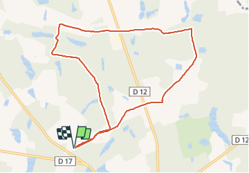

Longueur
9,6 km

Altitude max
133 m

Dénivelé positif
73 m
Km-Effort
10,6 km

Altitude min
116 m

Dénivelé négatif
73 m
Boucle
Oui
Date de création :
2018-12-14 09:21:29.11
Dernière modification :
2018-12-14 19:08:03.858
2h02
Difficulté : Très facile

Application GPS de randonnée GRATUITE
 SityTrail
IGN / Instituts géographiques
SityTrail Plus
Le monde est à vous
À propos
Randonnée Marche de 9,6 km à découvrir à Centre-Val de Loire, Loiret, Sennely. Cette randonnée est proposée par lemuid.
Localisation
Pays :
France
Région :
Centre-Val de Loire
Département/Province :
Loiret
Commune :
Sennely
Localité :
Unknown
Départ:(Dec)
Départ:(UTM)
434642 ; 5282133 (31T) N.
Commentaires