Randonnée Marche Saint-Jacques-en-Valgodemard - 20190409_Lac de Roaffan - Photo
 PapouBertrand
PapouBertrand

Utilisateur

© OpenStreetMap contributors
Longueur
Longueur
12,3 km
Altitude max
Altitude max
1265 m
Dénivelé positif
Dénivelé positif
429 m
Km-Effort
Km-Effort  
18 km
Altitude min
Altitude min
905 m
Dénivelé négatif
Dénivelé négatif
431 m
Boucle
Boucle
Oui
Date de création :
2019-04-09 07:26:36.929
Dernière modification :
2019-04-09 19:13:52.154

(0 Avis)

Marche
Marche
5h47
Difficulté : Facile

Scannez ce code QR pour ouvrir la randonnée dans l'application SityTrail

Application GPS de randonnée GRATUITE

Logo SityTrail SityTrail

IGN / Instituts géographiques

Télécharger SityTrail sur l'App Store Télécharger SityTrail sur Google Play

Logo SityTrail SityTrail World

Le monde est à vous

Télécharger SityTrail sur l'App Store Télécharger SityTrail sur Google Play Télécharger SityTrail sur Huawei AppGallery

À propos

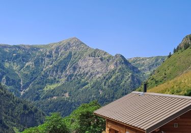
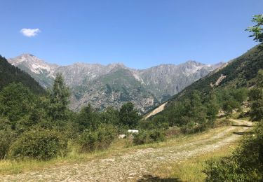
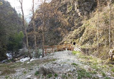
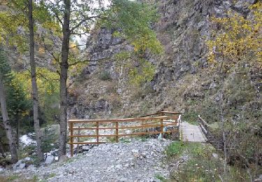
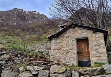
Randonnée Marche de 12,3 km à découvrir à Provence-Alpes-Côte d'Azur, Hautes-Alpes, Saint-Jacques-en-Valgodemard. Cette randonnée est proposée par PapouBertrand.

Description

Randonnée réalisée fin avril 2019 avec le CSA de Gap (4e Régiment de Chasseurs).
Petit circuit de 12 Km et d'environ 450 mètres de dénivelé sans difficulté avec de beaux points de vue.
Il est possible de partir de Saint-Jacques-en-Valgodemard.

Profil altimétrique

Photos

Localisation

Pays :
France
Région :
Provence-Alpes-Côte d'Azur
Département/Province :
Hautes-Alpes
Commune :
Saint-Jacques-en-Valgodemard
Localité :
Unknown
Départ:(UTM)
267432 ; 4962599 (32T) N.

Randonnées à proximité

Randonnée Marche Saint-Jacques-en-Valgodemard - Tour du Vieux Chaillol 1/5 - Gite Les Paris au Gite Le Casset - Photo
Marche
tracegps

Marche

Moyen
(1)
Saint-Jacques-en-Valgodemard, Provence-Alpes-Côte d'Azur, Hautes-Alpes, France
20 km | 27 km-effort
6h 30min
Non
Randonnée Marche Saint-Firmin - YHH081 Vallon de Prentiq - Photo
Marche
yveshumbert

Marche

Très facile
(1)
Saint-Firmin, Provence-Alpes-Côte d'Azur, Hautes-Alpes, France
6,7 km | 11,1 km-effort
2h 30min
Oui
Randonnée Marche La Motte-en-Champsaur - Jas de Jartier - Photo
Marche
Marco05

Marche

Difficile
La Motte-en-Champsaur, Provence-Alpes-Côte d'Azur, Hautes-Alpes, France
13,7 km | 24 km-effort
5h 22min
Oui
Randonnée Marche Saint-Firmin - Les pres hauts  6 kms - Photo
Marche
peillo

Marche

Saint-Firmin, Provence-Alpes-Côte d'Azur, Hautes-Alpes, France
5,2 km | 9,6 km-effort
1h 55min
Oui
Randonnée Marche Saint-Maurice-en-Valgodemard - Valgaudemard - chalets de Prentiq - Photo
Marche
ETMU5496

Marche

Moyen
Saint-Maurice-en-Valgodemard, Provence-Alpes-Côte d'Azur, Hautes-Alpes, France
12 km | 21 km-effort
3h 38min
Oui
Randonnée Marche Saint-Maurice-en-Valgodemard - Saint-Maurice-en-Valgaudemard - l'Ubac - Vallon de Prentiq - 14.9km 810m 6h50 (1h) - 2018 07 06 - Photo
Marche
Orcal37

Marche

Moyen
Saint-Maurice-en-Valgodemard, Provence-Alpes-Côte d'Azur, Hautes-Alpes, France
14,9 km | 26 km-effort
6h 50min
Oui
Randonnée Marche Saint-Maurice-en-Valgodemard - Chalets de Prenticq-Cabane du Sellar. - Photo
Marche
Dervalmarc

Marche

Facile
Saint-Maurice-en-Valgodemard, Provence-Alpes-Côte d'Azur, Hautes-Alpes, France
8,9 km | 16,3 km-effort
2h 57min
Oui
Randonnée Marche Saint-Maurice-en-Valgodemard - .Chalets de Prenticq. (11-10-15- - Photo
Marche
Dervalmarc

Marche

Facile
Saint-Maurice-en-Valgodemard, Provence-Alpes-Côte d'Azur, Hautes-Alpes, France
6,5 km | 11 km-effort
2h 9min
Oui
Randonnée Marche Saint-Maurice-en-Valgodemard - Cabanes de Richemont & la Salette - Photo
Marche
PapouBertrand

Marche

Très difficile
Saint-Maurice-en-Valgodemard, Provence-Alpes-Côte d'Azur, Hautes-Alpes, France
9,6 km | 21 km-effort
5h 0min
Oui


Fermer
Mes abonnements