Randonnée Marche Moliets-et-Maâ - La Chapelle Saint Laurent de Maa _ 8,5 km_Trace GPS - Photo

La Chapelle Saint Laurent de Maa _ 8,5 km_Trace GPS

 Pousscailleux
Pousscailleux

Utilisateur

© OpenStreetMap contributors
Longueur
Longueur
8,5 km
Altitude max
Altitude max
30 m
Dénivelé positif
Dénivelé positif
102 m
Km-Effort
Km-Effort  
9,9 km
Altitude min
Altitude min
10 m
Dénivelé négatif
Dénivelé négatif
101 m
Boucle
Boucle
Oui
Date de création :
2014-12-10 00:00:00.0
Dernière modification :
2014-12-10 00:00:00.0

(0 Avis)

Marche
Marche
2h02
Difficulté : Facile

Scannez ce code QR pour ouvrir la randonnée dans l'application SityTrail

Application GPS de randonnée GRATUITE

Logo SityTrail SityTrail

IGN / Instituts géographiques

Télécharger SityTrail sur l'App Store Télécharger SityTrail sur Google Play

Logo SityTrail SityTrail World

Le monde est à vous

Télécharger SityTrail sur l'App Store Télécharger SityTrail sur Google Play Télécharger SityTrail sur Huawei AppGallery

À propos

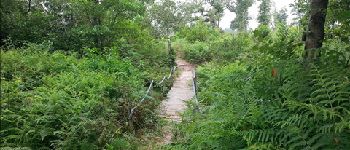
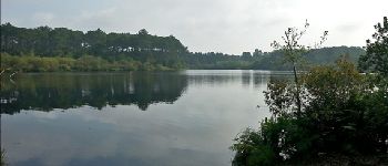
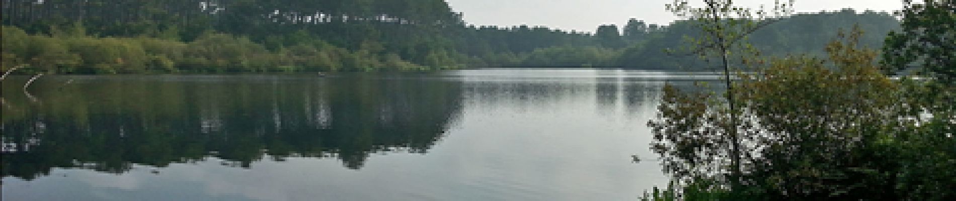
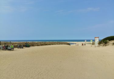
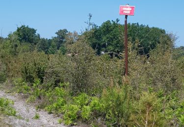
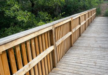
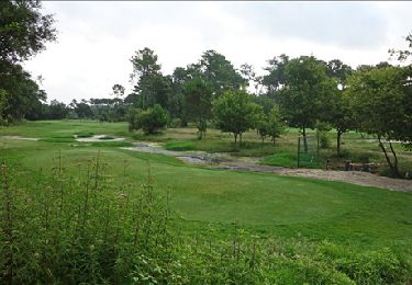
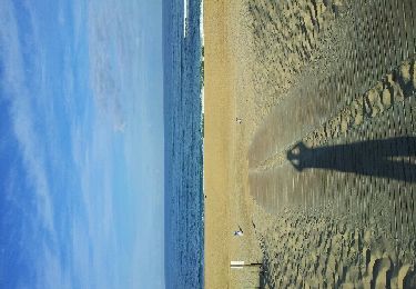
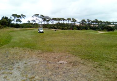
Randonnée Marche de 8,5 km à découvrir à Nouvelle-Aquitaine, Landes, Moliets-et-Maâ. Cette randonnée est proposée par Pousscailleux.

Description

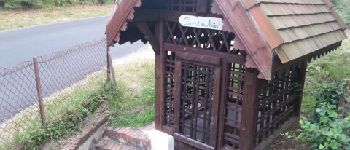
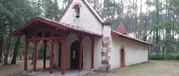
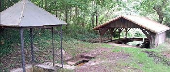
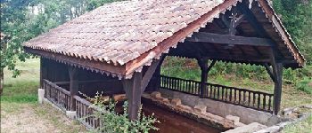
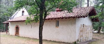
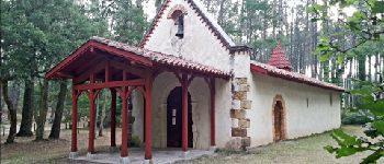
Lavoir et fontaine (Pourrut) de Maâ, Chapelle Saint Laurent sur le site d'une ancienne commanderie des Templiers.

Profil altimétrique

Photos

Points d'intérêt

Point d'intérêt Moliets-et-Maâ - Fontaine Saint Orens - Photo
Pousscailleux
MOLIETS-ET-MA 
Point d'intérêt Moliets-et-Maâ - Chapelle datant de l'époque des Templiers - Photo
Pousscailleux
Point d'intérêt Moliets-et-Maâ - Croix - Photo
Pousscailleux
MOLIETS-ET-MA 
Point d'intérêt Moliets-et-Maâ - Lavoir et Fontaine Notre Dame - Photo
Pousscailleux
Point d'intérêt Moliets-et-Maâ - Petit pont sur ru - Photo
Pousscailleux
MOLIETS-ET-MA 
Point d'intérêt Moliets-et-Maâ - Etang de Moliets - Photo
Pousscailleux
MOLIETS-ET-MA 
Point d'intérêt Moliets-et-Maâ - Lavoir - Photo
Pousscailleux
MOLIETS-ET-MA 
Point d'intérêt Moliets-et-Maâ - Arrière Chapelle St Laurent - Photo
Pousscailleux
Point d'intérêt Moliets-et-Maâ - Chapelle Saint Laurent - Photo
Pousscailleux
MOLIETS-ET-MA 

Localisation

Pays :
France
Région :
Nouvelle-Aquitaine
Département/Province :
Landes
Commune :
Moliets-et-Maâ
Localité :
Unknown
Départ:(Dec)
Départ:(UTM)
630891 ; 4856473 (30T) N.

Randonnées à proximité

Randonnée Marche Moliets-et-Maâ - MOLIETS le courant d huchet    290 7700 - Photo
Marche
GUIDE
marmotte65

Marche

Facile
Moliets-et-Maâ, Nouvelle-Aquitaine, Landes, France
5,8 km | 6,5 km-effort
1h 51min
Non
Randonnée Marche Léon - Etang VSP 10km - Photo
Marche
Marie Dony

Marche

Facile
(1)
Léon, Nouvelle-Aquitaine, Landes, France
10,2 km | 12,1 km-effort
2h 1min
Oui
Randonnée Marche Léon - Courant du Huchet - Photo
Marche
jaja64

Marche

Très facile
Léon, Nouvelle-Aquitaine, Landes, France
18,6 km | 21 km-effort
5h 30min
Non
Randonnée Marche Moliets-et-Maâ - circuit des Cigales camping au courant d'Uchet et retour - Photo
Marche
Forsans

Marche

Facile
Moliets-et-Maâ, Nouvelle-Aquitaine, Landes, France
6,5 km | 7,2 km-effort
1h 46min
Oui
Randonnée Marche Moliets-et-Maâ - Le Courant d' Huchet _ 5,3 km_Trace GPS - Photo
Marche
Pousscailleux

Marche

Très facile
Moliets-et-Maâ, Nouvelle-Aquitaine, Landes, France
5,3 km | 6,1 km-effort
1h 18min
Oui
Randonnée Marche Moliets-et-Maâ - Courant Huchet complet - Photo
Marche
eliott3

Marche

Très facile
(2)
Moliets-et-Maâ, Nouvelle-Aquitaine, Landes, France
15,1 km | 17,4 km-effort
3h 45min
Oui
Randonnée Marche Vielle-Saint-Girons - Ballade Courant Huchet - Photo
Marche
eliott3

Marche

Facile
(2)
Vielle-Saint-Girons, Nouvelle-Aquitaine, Landes, France
6,1 km | 7,2 km-effort
1h 34min
Oui
Randonnée V.T.T. Moliets-et-Maâ - molliet - Photo
V.T.T.
daliot

V.T.T.

Très facile
Moliets-et-Maâ, Nouvelle-Aquitaine, Landes, France
8,7 km | 9,7 km-effort
48min
Non
Randonnée Marche Moliets-et-Maâ - Golf - Photo
Marche
michelbarc

Marche

Très facile
Moliets-et-Maâ, Nouvelle-Aquitaine, Landes, France
7 km | 7,9 km-effort
1h 46min
Oui


Fermer
Mes abonnements