SityTrail - Obersteinbach - Falkenstein

thle
Utilisateur
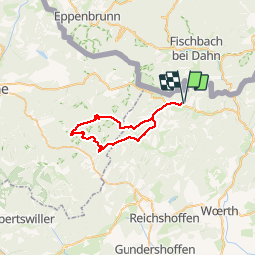

Longueur
34 km

Altitude max
388 m

Dénivelé positif
781 m
Km-Effort
45 km

Altitude min
218 m

Dénivelé négatif
781 m
Boucle
Oui
Date de création :
2019-06-18 16:05:52.312
Dernière modification :
2019-06-18 16:29:07.875
--
Difficulté : Moyen

Application GPS de randonnée GRATUITE
 SityTrail
IGN / Instituts géographiques
SityTrail Plus
Le monde est à vous
À propos
Randonnée Cheval de 34 km à découvrir à Grand Est, Bas-Rhin, Obersteinbach. Cette randonnée est proposée par thle.
Localisation
Pays :
France
Région :
Grand Est
Département/Province :
Bas-Rhin
Commune :
Obersteinbach
Localité :
Unknown
Départ:(Dec)
Départ:(UTM)
404579 ; 5432431 (32U) N.
Commentaires