![](/images/other/stat-length.png)
![Randonnée Marche Pornichet - Baie La Baule AR - Photo](https://media.geolcdn.com/t/1900/400/ext.pjpeg?maxdim=2&url=https%3A%2F%2Fstatic1.geolcdn.com%2Fsiteimages%2Fupload%2Ffiles%2F1553511878bg_sport_marche.png)
Baie La Baule AR
hl44lv
Utilisateur
![Longueur](/images/other/stat-length.png)
Longueur
15 km
![Altitude max](https://static1.geolcdn.com/siteimages/upload/files/1508320355ic_sort_altitude_max_24dp.png)
Altitude max
26 m
![Dénivelé positif](https://static1.geolcdn.com/siteimages/upload/files/1508320355ic_sort_den_pos_24dp.png)
Dénivelé positif
79 m
![Km-Effort](/images/other/stat-length.png)
Km-Effort
16 km
![Altitude min](https://static1.geolcdn.com/siteimages/upload/files/1508320355ic_sort_altitude_min_24dp.png)
Altitude min
-1 m
![Dénivelé négatif](https://static1.geolcdn.com/siteimages/upload/files/1508320355ic_sort_den_neg_24dp.png)
Dénivelé négatif
80 m
![Boucle](https://static1.geolcdn.com/siteimages/upload/files/16400158638029165_repeat_loop_refresh_sync_direction_icon.png)
Boucle
Oui
Date de création :
2019-07-01 08:08:32.0
Dernière modification :
2019-07-01 14:14:50.621
![Marche](https://static1.geolcdn.com/sitytour/trail-icons/101.png)
2h22
Difficulté : Inconnu
![Scannez ce code QR pour ouvrir la randonnée dans l'application SityTrail](https://capi.geolives.com/qq0zvz2zws4bq2lad0pu/sitytour/trails/2128054/qr.png?size=200)
Application GPS de randonnée GRATUITE
À propos
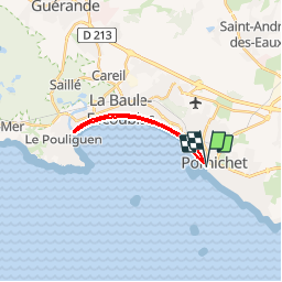
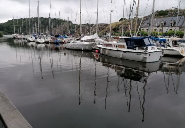
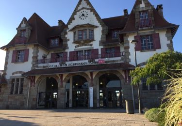
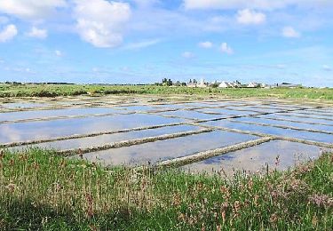
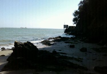
Randonnée Marche de 15 km à découvrir à Pays de la Loire, Loire-Atlantique, Pornichet. Cette randonnée est proposée par hl44lv.
Description
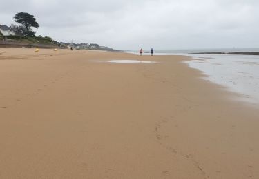
L'aller par la route, enfin le trottoir bien sûr, qui permet de mieux voir les différents immeubles notamment la partie "Benoit", vers Pouliguen. Retour en longeant l'eau. A faire de préférence matin tôt pour éviter le monde en saison touristique.
Localisation
Pays :
France
Région :
Pays de la Loire
Département/Province :
Loire-Atlantique
Commune :
Pornichet
Localité :
Unknown
Départ:(Dec)
Départ:(UTM)
549843 ; 5234211 (30T) N.
Commentaires
Randonnées à proximité
![Randonnée Marche Pornichet - promenade sur la plage - Photo](https://media.geolcdn.com/t/375/260/ext.jpg?maxdim=2&url=https%3A%2F%2Fstatic1.geolcdn.com%2Fsiteimages%2Fupload%2Ffiles%2F1553511878bg_sport_marche.png)
![Marche Marche](https://static1.geolcdn.com/sitytour/trail-icons/101.png)
promenade sur la plage
Marche
Très facile
(1)
Pornichet,
Pays de la Loire,
Loire-Atlantique,
France
![](/images/other/stat-length.png)
4,1 km | 4,4 km-effort
48min
![](https://static1.geolcdn.com/siteimages/upload/files/16400158638029165_repeat_loop_refresh_sync_direction_icon.png)
Oui
![Randonnée A pied La Baule-Escoublac - La petite marchande - Photo](https://media.geolcdn.com/t/375/260/ext.jpg?maxdim=2&url=https%3A%2F%2Fmedia.geolcdn.com%2Ff%2Fb24b4250-06ce-4584-9aac-6ea2632f3c33.jpeg)
![A pied A pied](https://static1.geolcdn.com/sitytour/trail-icons/100.png)
La petite marchande
A pied
Facile
La Baule-Escoublac,
Pays de la Loire,
Loire-Atlantique,
France
![](/images/other/stat-length.png)
10,3 km | 11,4 km-effort
2h 35min
![](https://static1.geolcdn.com/siteimages/upload/files/16400158638029165_repeat_loop_refresh_sync_direction_icon.png)
Oui
![Randonnée Marche La Baule-Escoublac - gare de Pornichet - Photo](https://media.geolcdn.com/t/375/260/ext.jpg?maxdim=2&url=https%3A%2F%2Fservices.sitytrail.com%2FGeolivesWS%2FDownloadMedia.ashx%3FTrailID%3D993054%26Media%3D20180624205634.jpg)
![Marche Marche](https://static1.geolcdn.com/sitytour/trail-icons/101.png)
gare de Pornichet
Marche
Très facile
La Baule-Escoublac,
Pays de la Loire,
Loire-Atlantique,
France
![](/images/other/stat-length.png)
6,1 km | 6,9 km-effort
1h 25min
![](https://static1.geolcdn.com/siteimages/upload/files/16400158638029165_repeat_loop_refresh_sync_direction_icon.png)
Oui
![Randonnée Marche nordique Pornichet - pornichet, ste Marguerite, hippodrome, port - Photo](https://media.geolcdn.com/t/375/260/ext.jpg?maxdim=2&url=https%3A%2F%2Fmedia.geolcdn.com%2Ff%2F5014ac05-bc50-4050-bdb1-018e9a4685dd.jpg)
![Marche nordique Marche nordique](https://static1.geolcdn.com/sitytour/trail-icons/102.png)
pornichet, ste Marguerite, hippodrome, port
Marche nordique
Très facile
Pornichet,
Pays de la Loire,
Loire-Atlantique,
France
![](/images/other/stat-length.png)
8,4 km | 9,3 km-effort
1h 15min
![](https://static1.geolcdn.com/siteimages/upload/files/16400158638029165_repeat_loop_refresh_sync_direction_icon.png)
Oui
![Randonnée Marche Pornichet - la Roche Bernard : les rosquets - Photo](https://media.geolcdn.com/t/375/260/ext.jpg?maxdim=2&url=https%3A%2F%2Fmedia.geolcdn.com%2Ff%2F4c26c2a3-d40c-4349-9ce6-405d71765763.jpg)
![Marche Marche](https://static1.geolcdn.com/sitytour/trail-icons/101.png)
la Roche Bernard : les rosquets
Marche
Facile
Pornichet,
Pays de la Loire,
Loire-Atlantique,
France
![](/images/other/stat-length.png)
32 km | 37 km-effort
5h 48min
![](https://static1.geolcdn.com/siteimages/upload/files/16400158638029165_repeat_loop_refresh_sync_direction_icon.png)
Non
![Randonnée Marche La Baule-Escoublac - gare La Baule Escoubac - Photo](https://media.geolcdn.com/t/375/260/ext.jpg?maxdim=2&url=https%3A%2F%2Fservices.sitytrail.com%2FGeolivesWS%2FDownloadMedia.ashx%3FTrailID%3D994300%26Media%3D20180626202507.jpg)
![Marche Marche](https://static1.geolcdn.com/sitytour/trail-icons/101.png)
gare La Baule Escoubac
Marche
Très facile
La Baule-Escoublac,
Pays de la Loire,
Loire-Atlantique,
France
![](/images/other/stat-length.png)
5,1 km | 5,7 km-effort
1h 2min
![](https://static1.geolcdn.com/siteimages/upload/files/16400158638029165_repeat_loop_refresh_sync_direction_icon.png)
Oui
![Randonnée Marche Guérande - Guérande_Careil - Photo](https://media.geolcdn.com/t/375/260/ext.jpg?maxdim=2&url=https%3A%2F%2Fservices.sitytrail.com%2FGeolivesWS%2FDownloadMedia.ashx%3FTrailID%3D415908%26Media%3D52a60e6b-5068-4f71-b8f3-923b38638fa7.jpg)
![Marche Marche](https://static1.geolcdn.com/sitytour/trail-icons/101.png)
Guérande_Careil
Marche
Moyen
Guérande,
Pays de la Loire,
Loire-Atlantique,
France
![](/images/other/stat-length.png)
13,5 km | 14,8 km-effort
4h 0min
![](https://static1.geolcdn.com/siteimages/upload/files/16400158638029165_repeat_loop_refresh_sync_direction_icon.png)
Oui
![Randonnée Marche Saint-Nazaire - St-Marc sur Mer - Photo](https://media.geolcdn.com/t/375/260/ext.jpg?maxdim=2&url=https%3A%2F%2Fservices.sitytrail.com%2FGeolivesWS%2FDownloadMedia.ashx%3FTrailID%3D119555%26Media%3D20120401144252.jpeg)
![Marche Marche](https://static1.geolcdn.com/sitytour/trail-icons/101.png)
St-Marc sur Mer
Marche
Facile
Saint-Nazaire,
Pays de la Loire,
Loire-Atlantique,
France
![](/images/other/stat-length.png)
13,4 km | 15,8 km-effort
2h 58min
![](https://static1.geolcdn.com/siteimages/upload/files/16400158638029165_repeat_loop_refresh_sync_direction_icon.png)
Oui
![Randonnée V.T.T. Saint-Nazaire - Tumulus de Dissignac - Photo](https://media.geolcdn.com/t/375/260/ext.jpg?maxdim=2&url=https%3A%2F%2Fservices.sitytrail.com%2FGeolivesWS%2FDownloadMedia.ashx%3FTrailID%3D101957%26Media%3D2250_1.jpg)
![V.T.T. V.T.T.](https://static1.geolcdn.com/sitytour/trail-icons/202.png)
Tumulus de Dissignac
V.T.T.
Facile
Saint-Nazaire,
Pays de la Loire,
Loire-Atlantique,
France
![](/images/other/stat-length.png)
12,5 km | 13,5 km-effort
45min
![](https://static1.geolcdn.com/siteimages/upload/files/16400158638029165_repeat_loop_refresh_sync_direction_icon.png)
Oui