


Wicklows2

dewaeph
Utilisateur

Longueur
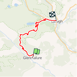
18 km

Altitude max
569 m

Dénivelé positif
548 m
Km-Effort
25 km

Altitude min
129 m

Dénivelé négatif
545 m
Boucle
Non
Date de création :
2019-07-20 08:22:51.477
Dernière modification :
2019-07-21 08:34:54.098
6h54
Difficulté : Très facile

Application GPS de randonnée GRATUITE
 SityTrail
IGN / Instituts géographiques
SityTrail Plus
Le monde est à vous
À propos
Randonnée Marche de 18 km à découvrir à Inconnu, County Wicklow, The Municipal District of Arklow. Cette randonnée est proposée par dewaeph.
Localisation
Pays :
Irlande
Région :
Inconnu
Département/Province :
County Wicklow
Commune :
The Municipal District of Arklow
Localité :
Knockrath
Départ:(Dec)
Départ:(UTM)
677760 ; 5870832 (29U) N.
Commentaires