


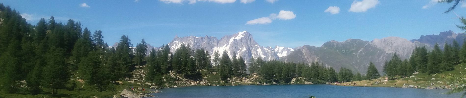
arpy . lac d arpy . arpy 2h50

stef789
Utilisateur GUIDE
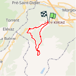

Longueur
10,3 km

Altitude max
2080 m

Dénivelé positif
438 m
Km-Effort
16,1 km

Altitude min
1680 m

Dénivelé négatif
416 m
Boucle
Oui
Date de création :
2019-08-04 11:08:58.538
Dernière modification :
2019-08-04 14:47:33.458
3h36
Difficulté : Très facile

Application GPS de randonnée GRATUITE
 SityTrail
IGN / Instituts géographiques
SityTrail Plus
Le monde est à vous
À propos
Randonnée Marche de 10,3 km à découvrir à Vallée d'Aoste, Inconnu, Morgex. Cette randonnée est proposée par stef789.
Description
allé via le torrent et retour trop d asphalte
Photos


Localisation
Pays :
Italie
Région :
Vallée d'Aoste
Département/Province :
Inconnu
Commune :
Morgex
Localité :
Unknown
Départ:(Dec)
Départ:(UTM)
345336 ; 5067955 (32T) N.
Commentaires