


bec-de-l'aigle-et-refuge-meige-coste

jeanic63
Utilisateur
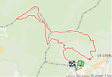

Longueur
14,7 km

Altitude max
1781 m

Dénivelé positif
902 m
Km-Effort
27 km

Altitude min
1244 m

Dénivelé négatif
901 m
Boucle
Oui
Date de création :
2019-09-06 11:30:47.863
Dernière modification :
2021-04-11 08:45:46.883
6h05
Difficulté : Très difficile

Application GPS de randonnée GRATUITE
 SityTrail
IGN / Instituts géographiques
SityTrail Plus
Le monde est à vous
À propos
Randonnée A pied de 14,7 km à découvrir à Auvergne-Rhône-Alpes, Cantal, Laveissière. Cette randonnée est proposée par jeanic63.
Description
départ col du font de cére
Localisation
Pays :
France
Région :
Auvergne-Rhône-Alpes
Département/Province :
Cantal
Commune :
Laveissière
Localité :
Unknown
Départ:(Dec)
Départ:(UTM)
479050 ; 4992462 (31T) N.
Commentaires