Randonnée Marche Vingrau - 20201219 Vingrau - trauc del cavall - Photo

20201219 Vingrau - trauc del cavall

 ThonyM
ThonyM

Utilisateur

© OpenStreetMap contributors
Longueur
Longueur
16,9 km
Altitude max
Altitude max
551 m
Dénivelé positif
Dénivelé positif
522 m
Km-Effort
Km-Effort  
24 km
Altitude min
Altitude min
142 m
Dénivelé négatif
Dénivelé négatif
522 m
Boucle
Boucle
Oui
Date de création :
2020-12-19 08:08:32.0
Dernière modification :
2020-12-19 14:47:31.054

(0 Avis)

Marche
Marche
4h49
Difficulté : Difficile

Scannez ce code QR pour ouvrir la randonnée dans l'application SityTrail

Application GPS de randonnée GRATUITE

Logo SityTrail SityTrail

IGN / Instituts géographiques

Télécharger SityTrail sur l'App Store Télécharger SityTrail sur Google Play

Logo SityTrail SityTrail World

Le monde est à vous

Télécharger SityTrail sur l'App Store Télécharger SityTrail sur Google Play Télécharger SityTrail sur Huawei AppGallery

À propos

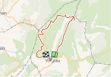
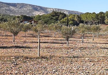
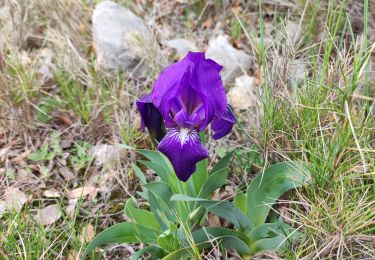
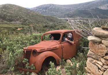
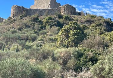
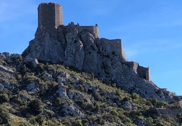
Randonnée Marche de 16,9 km à découvrir à Occitanie, Pyrénées-Orientales, Vingrau. Cette randonnée est proposée par ThonyM.

Description

Très beau parcours sportif après le trauc del cavall. Attention après le trauc dans la courte descente ne pas louper la montée vers la droite

Profil altimétrique

Photos

Localisation

Pays :
France
Région :
Occitanie
Département/Province :
Pyrénées-Orientales
Commune :
Vingrau
Localité :
Unknown
Départ:(Dec)
Départ:(UTM)
481739 ; 4743976 (31T) N.

Randonnées à proximité

Randonnée Marche Tautavel - Tautavel chemin des bacs - Photo
Marche
jcmartin

Marche

Facile
(3)
Tautavel, Occitanie, Pyrénées-Orientales, France
9,5 km | 12,4 km-effort
2h 30min
Oui
Randonnée Marche Vingrau - Chemin des Contrebandiers Vingrau variante - Photo
Marche
force

Marche

Moyen
(2)
Vingrau, Occitanie, Pyrénées-Orientales, France
10,4 km | 16 km-effort
3h 30min
Oui
Randonnée Marche Vingrau - Vingrau - Photo
Marche
GUIDE
Ada11

Marche

Moyen
Vingrau, Occitanie, Pyrénées-Orientales, France
15,5 km | 22 km-effort
4h 20min
Oui
Randonnée Marche Espira-de-l'Agly - espira montpins - Photo
Marche
66Gribouille83

Marche

Moyen
Espira-de-l'Agly, Occitanie, Pyrénées-Orientales, France
9,2 km | 11,3 km-effort
2h 48min
Oui
Randonnée Marche Paziols - paziols 19 kms - Photo
Marche
cappelle

Marche

Moyen
Paziols, Occitanie, Aude, France
18,6 km | 26 km-effort
6h 0min
Oui
Randonnée Marche Tuchan - 20220310 Tuchan-Padern - Photo
Marche
ThonyM

Marche

Moyen
Tuchan, Occitanie, Aude, France
23 km | 34 km-effort
5h 16min
Oui
Randonnée Marche Paziols - Paziols château d’aguilra - Photo
Marche
ombrabella

Marche

Très facile
Paziols, Occitanie, Aude, France
15,1 km | 18,8 km-effort
4h 4min
Oui
Randonnée Marche Tuchan - 20211007 Tuchan-Padern-Queribus-Cucugnan - Photo
Marche
ThonyM

Marche

Moyen
Tuchan, Occitanie, Aude, France
25 km | 37 km-effort
5h 58min
Non
Randonnée Marche Tautavel - TAUTAVEL la Tour del Far A/R - Photo
Marche
MarieFrancoise

Marche

Moyen
Tautavel, Occitanie, Pyrénées-Orientales, France
6,3 km | 11,4 km-effort
3h 55min
Oui


Fermer
Mes abonnements