Randonnée Marche Saint-Brès - Saint-Brès-30500 - Photo

Saint-Brès-30500

 ganinette
ganinette

Utilisateur

© OpenStreetMap contributors
Longueur
Longueur
5,9 km
Altitude max
Altitude max
300 m
Dénivelé positif
Dénivelé positif
142 m
Km-Effort
Km-Effort  
7,8 km
Altitude min
Altitude min
161 m
Dénivelé négatif
Dénivelé négatif
140 m
Boucle
Boucle
Oui
Date de création :
2021-02-11 19:50:26.349
Dernière modification :
2021-02-13 09:42:45.003

(0 Avis)

Marche
Marche
1h17
Difficulté : Facile

Scannez ce code QR pour ouvrir la randonnée dans l'application SityTrail

Application GPS de randonnée GRATUITE

Logo SityTrail SityTrail

IGN / Instituts géographiques

Télécharger SityTrail sur l'App Store Télécharger SityTrail sur Google Play

Logo SityTrail SityTrail World

Le monde est à vous

Télécharger SityTrail sur l'App Store Télécharger SityTrail sur Google Play Télécharger SityTrail sur Huawei AppGallery

À propos

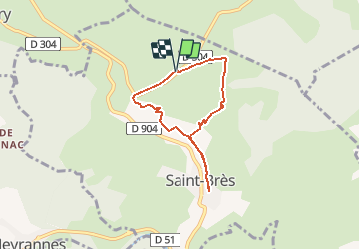
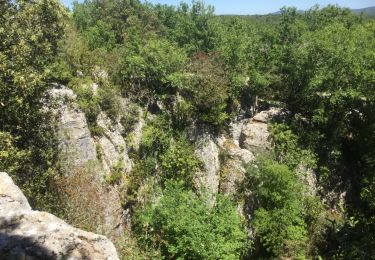
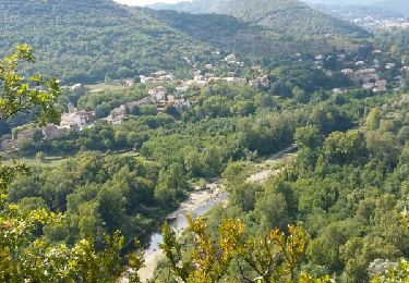
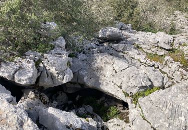
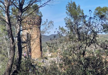
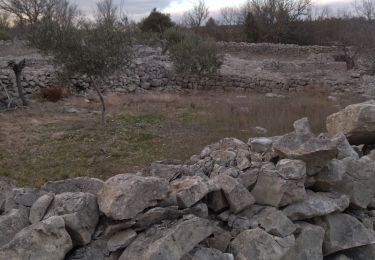
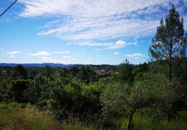
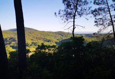
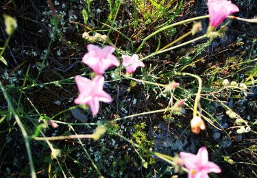
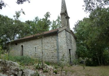
Randonnée Marche de 5,9 km à découvrir à Occitanie, Gard, Saint-Brès. Cette randonnée est proposée par ganinette.

Profil altimétrique

Localisation

Pays :
France
Région :
Occitanie
Département/Province :
Gard
Commune :
Saint-Brès
Localité :
Unknown
Départ:(UTM)
595280 ; 4904986 (31T) N.

Randonnées à proximité

Randonnée Marche Saint-Paul-le-Jeune - 07 Résurgence de cotepatiere ( cocalhere) 17-04-18 - Photo
Marche
silvestreclaudine

Marche

Très facile
(1)
Saint-Paul-le-Jeune, Auvergne-Rhône-Alpes, Ardèche, France
12,9 km | 15,1 km-effort
4h 46min
Oui
Randonnée Marche Molières-sur-Cèze - moliere sur ceze - Photo
Marche
HILLEBRAND

Marche

Facile
(2)
Molières-sur-Cèze, Occitanie, Gard, France
4,6 km | 6,1 km-effort
2h 6min
Oui
Randonnée Marche Saint-André-de-Cruzières - CHADOUILLET - Photo
Marche
asclier0

Marche

Moyen
Saint-André-de-Cruzières, Auvergne-Rhône-Alpes, Ardèche, France
7,8 km | 9,4 km-effort
2h 8min
Oui
Randonnée Marche Saint-Ambroix - Autour de St Ambroix  - Photo
Marche
GUIDE
nadinebondoux

Marche

Moyen
Saint-Ambroix, Occitanie, Gard, France
18,6 km | 27 km-effort
5h 39min
Oui
Randonnée Marche Saint-André-de-Cruzières - 07 chandouillet grotte cotepatiere sauvas peyrejol - Photo
Marche
himba26100

Marche

Moyen
Saint-André-de-Cruzières, Auvergne-Rhône-Alpes, Ardèche, France
17,8 km | 24 km-effort
7h 47min
Oui
Randonnée Marche nordique Saint-Ambroix - 06.06.20 montèze  - Photo
Marche nordique
suzanne.bron

Marche nordique

Très facile
Saint-Ambroix, Occitanie, Gard, France
10 km | 15,2 km-effort
2h 42min
Oui
Randonnée Marche nordique Saint-Ambroix - 24.05.20 montèze - Photo
Marche nordique
suzanne.bron

Marche nordique

Très facile
Saint-Ambroix, Occitanie, Gard, France
7,4 km | 11,3 km-effort
2h 9min
Non
Randonnée Marche nordique Saint-Ambroix - 20.05.20 piste  - Photo
Marche nordique
suzanne.bron

Marche nordique

Très facile
Saint-Ambroix, Occitanie, Gard, France
10,9 km | 15,1 km-effort
2h 36min
Oui
Randonnée Marche Saint-André-de-Cruzières - Montagne de la Serre - Saint André de Cruzières - Photo
Marche
tracegps

Marche

Difficile
Saint-André-de-Cruzières, Auvergne-Rhône-Alpes, Ardèche, France
17,9 km | 25 km-effort
5h 0min
Oui


Fermer
Mes abonnements