![](/images/other/stat-length.png)
![Randonnée Marche Montaud - La Dent de Moirans - Photo](https://media.geolcdn.com/t/1900/400/ext.pjpeg?maxdim=2&url=https%3A%2F%2Fmedia.geolcdn.com%2Ff%2F42159542-0525-485e-906a-e99c0c2c152d.jpg)
La Dent de Moirans
patjobou
Utilisateur
![Longueur](/images/other/stat-length.png)
Longueur
11 km
![Altitude max](https://static1.geolcdn.com/siteimages/upload/files/1508320355ic_sort_altitude_max_24dp.png)
Altitude max
990 m
![Dénivelé positif](https://static1.geolcdn.com/siteimages/upload/files/1508320355ic_sort_den_pos_24dp.png)
Dénivelé positif
406 m
![Km-Effort](/images/other/stat-length.png)
Km-Effort
16,4 km
![Altitude min](https://static1.geolcdn.com/siteimages/upload/files/1508320355ic_sort_altitude_min_24dp.png)
Altitude min
670 m
![Dénivelé négatif](https://static1.geolcdn.com/siteimages/upload/files/1508320355ic_sort_den_neg_24dp.png)
Dénivelé négatif
406 m
![Boucle](https://static1.geolcdn.com/siteimages/upload/files/16400158638029165_repeat_loop_refresh_sync_direction_icon.png)
Boucle
Oui
Date de création :
2021-05-13 08:35:43.37
Dernière modification :
2021-05-13 17:58:24.518
![Marche](https://static1.geolcdn.com/sitytour/trail-icons/101.png)
4h38
Difficulté : Facile
![Scannez ce code QR pour ouvrir la randonnée dans l'application SityTrail](https://capi.geolives.com/qq0zvz2zws4bq2lad0pu/sitytour/trails/2785072/qr.png?size=200)
Application GPS de randonnée GRATUITE
À propos
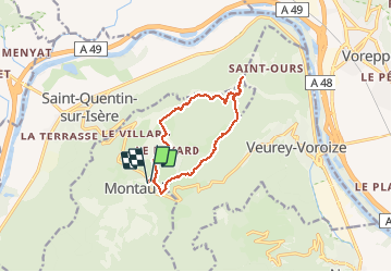
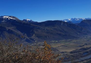
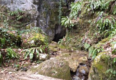
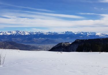
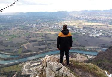
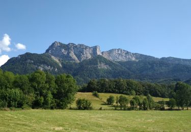
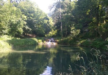
Randonnée Marche de 11 km à découvrir à Auvergne-Rhône-Alpes, Isère, Montaud. Cette randonnée est proposée par patjobou.
Description
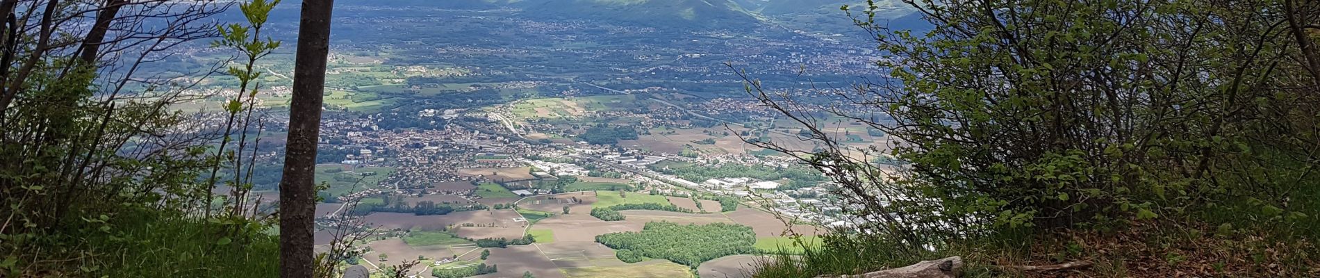
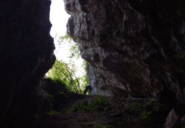
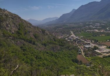
Belle boucle sans difficulté, dans une belle forêt de feuillus. Parcours sur le vieux sentiers empierrés. Dommage qu'ils soient partiellement endommagés par des travaux forestiers. Souhaitons qu'ils soient remis en état.
Localisation
Pays :
France
Région :
Auvergne-Rhône-Alpes
Département/Province :
Isère
Commune :
Montaud
Localité :
Unknown
Départ:(Dec)
Départ:(UTM)
701343 ; 5015562 (31T) N.
Commentaires
Randonnées à proximité
![Randonnée Marche Voreppe - le trou au loup - Photo](https://media.geolcdn.com/t/375/260/ext.jpg?maxdim=2&url=https%3A%2F%2Fmedia.geolcdn.com%2Ff%2F4be90cdf-26f4-4d2a-b22f-02f0baa87490.jpg)
![Marche Marche](https://static1.geolcdn.com/sitytour/trail-icons/101.png)
le trou au loup
Marche
Difficile
Voreppe,
Auvergne-Rhône-Alpes,
Isère,
France
![](/images/other/stat-length.png)
8,5 km | 16,5 km-effort
6h 29min
![](https://static1.geolcdn.com/siteimages/upload/files/16400158638029165_repeat_loop_refresh_sync_direction_icon.png)
Oui
![Randonnée Marche Voreppe - 38 voreppe - Photo](https://media.geolcdn.com/t/375/260/ext.jpg?maxdim=2&url=https%3A%2F%2Fmedia.geolcdn.com%2Ff%2Fae534631-eaae-45ff-8bde-8ca8e28aadbe.jpg)
![Marche Marche](https://static1.geolcdn.com/sitytour/trail-icons/101.png)
38 voreppe
Marche
Moyen
Voreppe,
Auvergne-Rhône-Alpes,
Isère,
France
![](/images/other/stat-length.png)
8,7 km | 16,8 km-effort
6h 25min
![](https://static1.geolcdn.com/siteimages/upload/files/16400158638029165_repeat_loop_refresh_sync_direction_icon.png)
Oui
![Randonnée Marche Saint-Quentin-sur-Isère - Dent de Moirans - Photo](https://media.geolcdn.com/t/375/260/ext.jpg?maxdim=2&url=https%3A%2F%2Fmedia.geolcdn.com%2Ff%2Fcc5b3296-26ad-4d08-b80e-e1eedf7283f6.jpg)
![Marche Marche](https://static1.geolcdn.com/sitytour/trail-icons/101.png)
Dent de Moirans
Marche
Très difficile
Saint-Quentin-sur-Isère,
Auvergne-Rhône-Alpes,
Isère,
France
![](/images/other/stat-length.png)
14,7 km | 26 km-effort
6h 17min
![](https://static1.geolcdn.com/siteimages/upload/files/16400158638029165_repeat_loop_refresh_sync_direction_icon.png)
Oui
![Randonnée Marche Saint-Quentin-sur-Isère - 38 St Quentin sur isere - Photo](https://media.geolcdn.com/t/375/260/ext.jpg?maxdim=2&url=https%3A%2F%2Fmedia.geolcdn.com%2Ff%2Fa8213203-4838-4b30-a9a1-6f63f9fa0c7f.jpg)
![Marche Marche](https://static1.geolcdn.com/sitytour/trail-icons/101.png)
38 St Quentin sur isere
Marche
Moyen
Saint-Quentin-sur-Isère,
Auvergne-Rhône-Alpes,
Isère,
France
![](/images/other/stat-length.png)
17 km | 28 km-effort
7h 22min
![](https://static1.geolcdn.com/siteimages/upload/files/16400158638029165_repeat_loop_refresh_sync_direction_icon.png)
Oui
![Randonnée Raquettes à neige Autrans-Méaudre en Vercors - La Grande Brèche - La Buffe - La Sure (2022) - Photo](https://media.geolcdn.com/t/375/260/ext.jpg?maxdim=2&url=https%3A%2F%2Fmedia.geolcdn.com%2Ff%2F0ed3592b-52f6-40cf-babc-f54ce22268ca.jpg)
![Raquettes à neige Raquettes à neige](https://static1.geolcdn.com/sitytour/trail-icons/504.png)
La Grande Brèche - La Buffe - La Sure (2022)
Raquettes à neige
Moyen
Autrans-Méaudre en Vercors,
Auvergne-Rhône-Alpes,
Isère,
France
![](/images/other/stat-length.png)
12,9 km | 22 km-effort
4h 28min
![](https://static1.geolcdn.com/siteimages/upload/files/16400158638029165_repeat_loop_refresh_sync_direction_icon.png)
Oui
![Randonnée Marche Autrans-Méaudre en Vercors - boucle la Buffe - la Sure - Photo](https://media.geolcdn.com/t/375/260/ext.jpg?maxdim=2&url=https%3A%2F%2Fmedia.geolcdn.com%2Ff%2F9d650f75-523f-40ee-a83c-0bfaf17ae3cc.jpg)
![Marche Marche](https://static1.geolcdn.com/sitytour/trail-icons/101.png)
boucle la Buffe - la Sure
Marche
Difficile
Autrans-Méaudre en Vercors,
Auvergne-Rhône-Alpes,
Isère,
France
![](/images/other/stat-length.png)
8,6 km | 16,1 km-effort
4h 52min
![](https://static1.geolcdn.com/siteimages/upload/files/16400158638029165_repeat_loop_refresh_sync_direction_icon.png)
Oui
![Randonnée Marche Montaud - La dent de Moirans - Photo](https://media.geolcdn.com/t/375/260/ext.jpg?maxdim=2&url=https%3A%2F%2Fmedia.geolcdn.com%2Ff%2Fc31d5ba7-98c1-4d2c-8f51-1281362b0eb5.jpg)
![Marche Marche](https://static1.geolcdn.com/sitytour/trail-icons/101.png)
La dent de Moirans
Marche
Très facile
(1)
Montaud,
Auvergne-Rhône-Alpes,
Isère,
France
![](/images/other/stat-length.png)
8,9 km | 13,5 km-effort
2h 57min
![](https://static1.geolcdn.com/siteimages/upload/files/16400158638029165_repeat_loop_refresh_sync_direction_icon.png)
Oui
![Randonnée Marche Montaud - BOUCLE MONTAUD DE T DE MOIRANS - Photo](https://media.geolcdn.com/t/375/260/ext.jpg?maxdim=2&url=https%3A%2F%2Fmedia.geolcdn.com%2Ff%2Fe130ea2b-4587-4c00-ae7c-a57eb66385d6.jpg)
![Marche Marche](https://static1.geolcdn.com/sitytour/trail-icons/101.png)
BOUCLE MONTAUD DE T DE MOIRANS
Marche
Moyen
Montaud,
Auvergne-Rhône-Alpes,
Isère,
France
![](/images/other/stat-length.png)
11,1 km | 16,7 km-effort
3h 12min
![](https://static1.geolcdn.com/siteimages/upload/files/16400158638029165_repeat_loop_refresh_sync_direction_icon.png)
Oui
![Randonnée Marche Saint-Quentin-sur-Isère - st Quentin montaud boucle - Photo](https://media.geolcdn.com/t/375/260/ext.jpg?maxdim=2&url=https%3A%2F%2Fmedia.geolcdn.com%2Ff%2F0aa42cac-7efa-41f8-ab64-12fb04627411.jpg)
![Marche Marche](https://static1.geolcdn.com/sitytour/trail-icons/101.png)
st Quentin montaud boucle
Marche
Moyen
Saint-Quentin-sur-Isère,
Auvergne-Rhône-Alpes,
Isère,
France
![](/images/other/stat-length.png)
8,9 km | 16,3 km-effort
2h 58min
![](https://static1.geolcdn.com/siteimages/upload/files/16400158638029165_repeat_loop_refresh_sync_direction_icon.png)
Oui